Altona
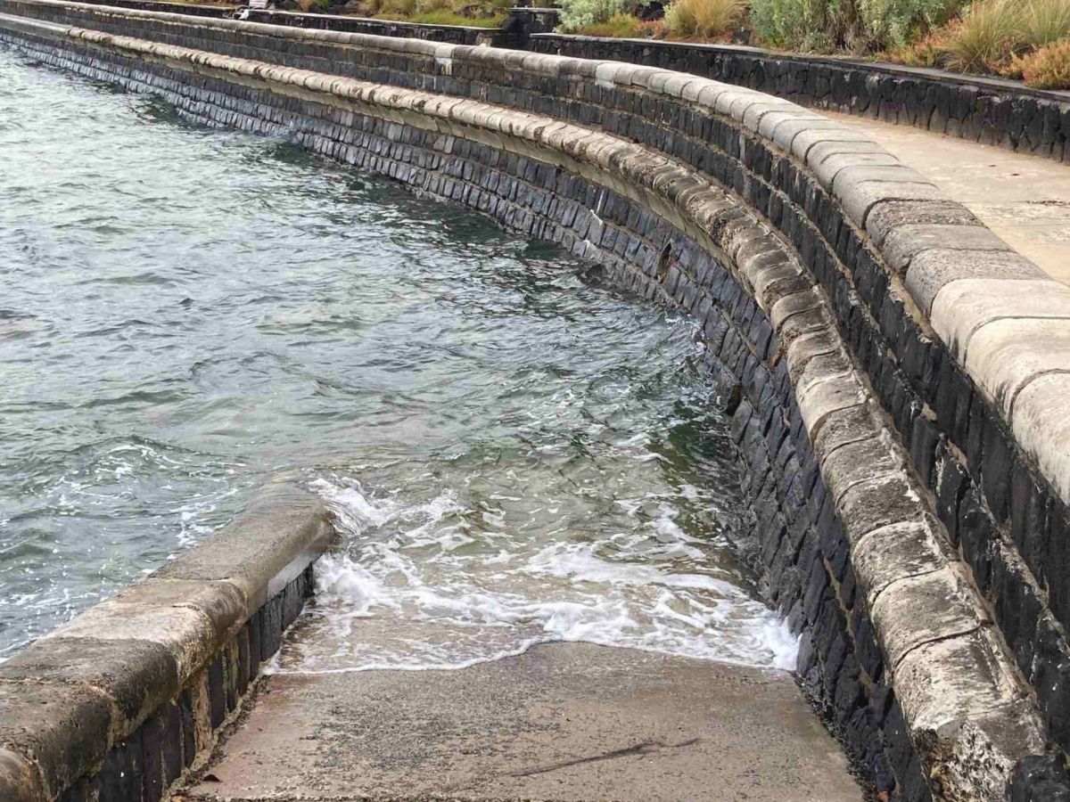
DEECA is repairing parts of the seawall at Altona Foreshore. The repairs will stabilise and protect the existing seawall and foreshore area from more erosion and structural damage.
Location: Altona Foreshore, opposite G.H. Ransom Reserve Playground (refer Figure 1).
Timing: Contractors will start onsite works from Monday 17 November 2025. Works are expected to be complete within approximately 10 business days, subject to weather and tidal conditions.
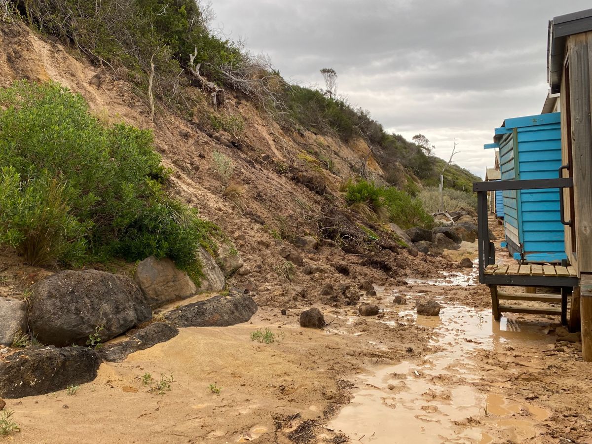
Why are the works taking place? Engineers found significant scour and undercutting along sections of the seawall. This is due to redirected creek flows and storm activity. The repairs are needed to stop more damage and keep the area safe for everyone.
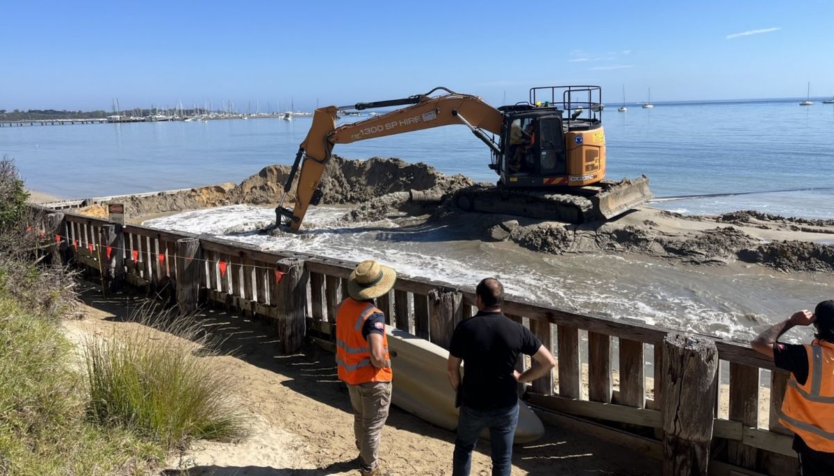
What's happening? The works will involve:
- reshaping eroded sections of the foreshore
- constructing a short training wall to redirect creek flows away from the seawall
- reinstating the foreshore using sand sourced on site.
This will help protect nearby public assets, including the Bay Trail and Esplanade.
What to expect:
- Machinery and materials will be placed on public land along the Altona Foreshore, across from G.H. Ransom Reserve Playground.
- Trucks will use The Esplanade, across from G.H. Ransom Reserve Playground, to deliver and move sand while the work is happening.
- Parts of the Bay Trail in front of the works site will be reduced to one lane so that machines and vehicles can get through safely.
- The foreshore area in front of the works site will be closed during construction to keep people safe. It will reopen when the work is finished.
- There will be some noise and truck activity during standard working hours (Monday to Friday, 7 am to 6 pm).
- The contractor will try to minimise disruptions and will fix up any areas affected by the work once it’s done.
Figure 1 Location of work site at The Esplanade, opposite G.H. Ransom Reserve Playground.

Remediation
For more information, read our factsheets:
Black Rock
Location: Black Rock foreshore
Timing: October 2024 – March 2025
Details: Improvements are being made to the Black Rock masonry seawall. The seawall protects nearby assets, including the Promenade, coastal cliffs and infrastructure.
Recent inspections found significant deterioration of the seawall.
These repair works will restore its strength and functionality, mitigate future coastal hazards, and ensure the seawall can continue protecting the Bay Trail and surrounding areas into the future.
While construction is underway, pedestrian detours may be required. Pathway closures will be kept to a minimum.
A section of the B16 car park will be closed while works occur.
Blairgowrie
Location: Blairgowrie Beach – two sections between Inverness Ave. and Revell St, Whitecliffs Beach, and Tootgarook – between Laura St. and Kevin St.
Timing: Completed June 2022.
Details: Sections of beach between Blairgowrie and Tootgarook are eroding through natural sand loss processes.
In partnership with Mornington Peninsula Shire Council (MPSC), Capel Sound Foreshores and Whitecliffs to Cameron’s Bight Foreshore Reserve Committees of Management, DEECA has delivered over 30,000 m3 of sand to Blairgowrie Beach, Whitecliffs Beach and Tootgarook.
The nourishments will protect the beaches for the community and public infrastructure including Point Nepean Road, the campground, walking paths and power poles.
These nourishments were delivered as part of the Port Phillip Bay Beaches Renourishment Program (now closed).
Brighton
Location: Bay St, Brighton
Timing: October 2024 – December 2024
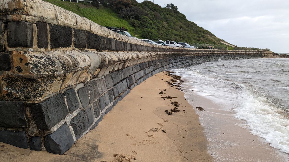
Details: Improvements are being made to the Bay St masonry seawall.
The seawall protects nearby assets, including the Bay Trail and beach access tracks.
Recent inspections found significant deterioration of the seawall.
These repair works will restore its strength and functionality, mitigate future coastal hazards, and ensure the seawall can continue protecting the Bay Trail and surrounding areas into the future.
While construction is underway, pedestrian detours may be required. Pathway closures will be kept to a minimum.
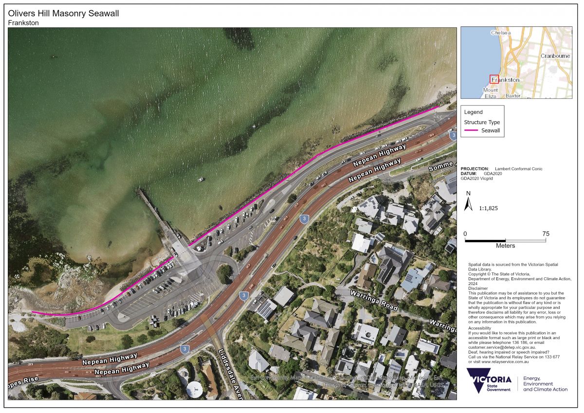
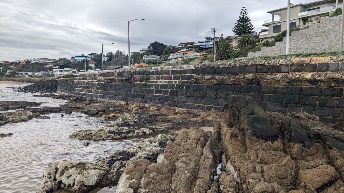
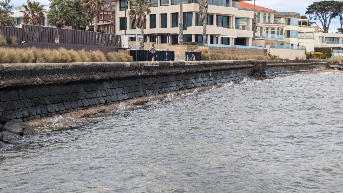
Frankston
Location: Olivers Hill, Frankston
Timing: May 2024 – March 2025
Details: The Olivers Hill masonry seawall prevents coastal erosion and protects assets nearby. These assets include the Olivers Hill carpark, boat ramp, and walking paths.
Most of the seawall is made of bluestone blocks held together with mortar. The total length of the seawall is 465 metres, and it has an average height of 2.3 metres. Recent inspections found significant issues with the seawall. This includes material loss, and deterioration of mortar and concrete blocks. This puts nearby infrastructure (like the carpark and walking paths) at risk.
Our works will restore the seawall's strength and functionality. We will remove damaged parts, and bluestone and concrete capping blocks will be fixed. This will mitigate future coastal hazards, making sure the seawall can continue protecting the Olivers Hill carpark and surrounds into the future.
Mordialloc
Mt Eliza
Location: Sunnyside Beach, Sunnyside Road, Mt Eliza
Timing: Interim repairs to be completed by mid-2023.
Details: A rock revetment protecting the car park, water station and public toilets has been eroded. DEECA is currently analysing repair options, including rebuilding the revetment and extending it by approximately 180 metres, or relocating/retreating the car park and public toilets.
In August 2022, staff identified a failing a drainage pit behind the revetment. This has allowed water to run around the outside of a pipe, undermining and causing a hole in the revetment.
DEECA, Mornington Peninsula Shire Council (MPSC) and engineers have collaborated on remediation and future adaptation pathways for this asset. DEECA and MPSC have developed risk assessments and are currently assessing future options. DEECA has also received quotes to repair the damage to ensure the area’s short-term safety.
Mt Martha
Mt Martha North Beach erosion management
Location: Mt Martha North Beach
Timing: Geotechnical inclinometer report complete February 2023.
Details: Beach and cliff erosion occurs at Mount Martha North due to ongoing, natural processes.
Ongoing management of the erosion presents challenges in balancing the needs and safety of beach users, beach box owners, and the responsibilities of land managers, while protecting the natural environment.
DEECA has undertaken several actions to limit the effects of erosion in the short-to-medium term, including:
- 2010: beach nourishment and construction of a 100m long revetment at the northern end of Mount Martha North beach
- 2017: coastal processes study
- 2018: construction of a temporary rock revetment to protect the base of the cliff from erosion
- 2018: options analysis undertaken to model and cost other recommended coastal structures
- 2019–2023: geotechnical inclinometer monitoring carried out quarterly
- 2021: geotechnical report.
Coastal processes are complex, and actions taken in one location can have significant, often unintended impacts elsewhere.
The primary objectives for DEECA are to maintain public safety for the Mount Martha North beach and protect the natural assets and public infrastructure.
The issue continues to be monitored closely in partnership with MPSC. Keep up to date by visiting the MPSC website – Mount Martha North Beach and Cliff.
Portsea
Location: Portsea Front Beach
Timing: Major repairs to sandbag seawall completed in mid-2020.
Details: Since 2009, Portsea Front Beach has experienced significant erosion due to ongoing swell waves. Repairs to the protective sandbag in 2020 have extended the life of the structure.
DEECA and Mornington Peninsula Shire Council (MPSC) have conducted several investigations and works since 2010. These include:
- 2010: sandbag seawall built, and pier stabilisation works.
- 2012: pre-feasibility study into management options. Sand monitoring program.
- 2014–2016: wave modelling and monitoring investigation carried out over two-year period by Worley Parsons.
- 2014: rock seawall constructed to replace retaining wall west of Portsea jetty.
- 2016: Portsea Front Beach Options Analysis study.
- 2020: major repairs to the sandbag seawall and geotechnical investigation on cliffs east of the seawall.
DEECA continues to work with MPSC together to identify evidence-based, sustainable options to manage coastal hazards at this site.
For more information visit the MPSC website – Portsea Front Beach.
Sandringham
Location: Sandringham Beach, Southey Street
Timing:
- Groyne construction - October to December 2017
- Beach nourishment - December 2021
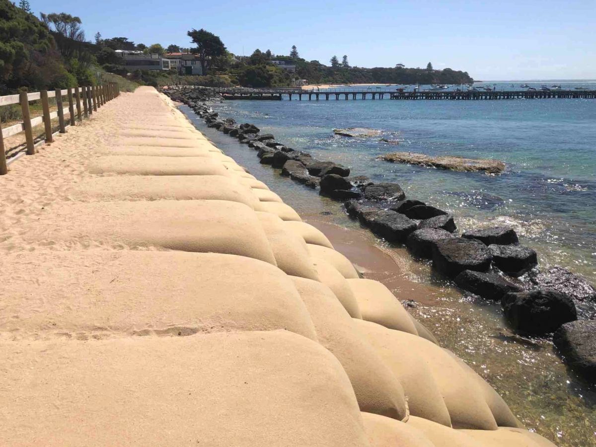
Details: The Southey Street and Royal Avenue rock groynes have successfully anchored the sand to the beach south of the groynes, thereby protecting the most vulnerable section of the cliffs.
However, the groynes prevent some northbound sand from reaching the Southey Street beach, resulting in a loss of the beach and some cliff erosion north of Southey Street during summer.
Following extensive community consultation the Southey Street groyne was shortened to encourage more sand migration.
The groynes were modified and the beach was nourished in 2021, with more than 20,000 m3 of sand to nourish two target areas, one main area at Edwards Street Beach, Sandringham, and another at Half Moon Bay.
Sandringham is now part of the Victorian Coastal Monitoring Program.
Somers
Location: Somers Foreshore
Timing: July – September 2025
Details: We’re carrying out maintenance at Somers Foreshore to make the rock revetment safer for the community. The old timber seawall will be removed and the nearby rocks reshaped and stabilised. Temporary beach access changes may be in place during construction, with alternative access available via The Promenade staircase.
Coastal erosion and other related pages
Image gallery
Page last updated: 27/04/26