What is Blue Carbon?
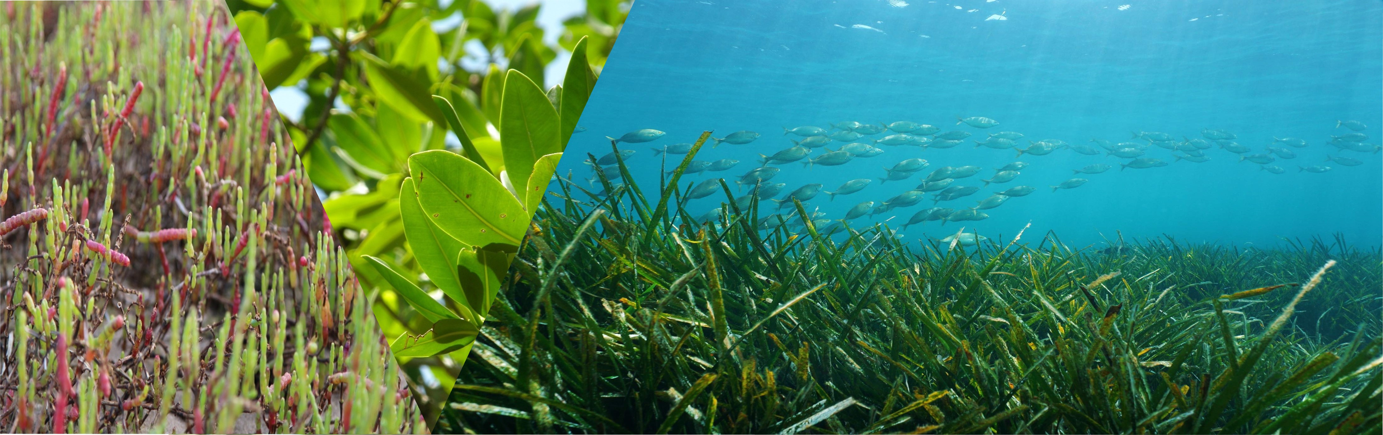
Blue carbon is the carbon stored by marine and coastal ecosystems. Habitats such as seagrass, mangrove, and saltmarsh, are recognised for their important role in climate mitigation by their ability to sequester significant amounts of atmospheric carbon.
Victoria’s marine and coastal ecosystems support >60,000 ha of blue carbon habitats within its bays and inlets and has the world’s most southern mangrove occurrence. These critical habitats not only provide nature-based solutions for carbon abatement but also deliver numerous benefits including coastal protection from storms, sea level rise and shoreline erosion, improved water quality, nursery grounds for commercially important fisheries, refuge for endangered marine species as well as significant heritage and cultural value for Traditional Owners.
The Emission Reduction Fund (ERF) under the Clean Energy Regulator, has released the first blue carbon restoration method (BlueCAM) in January 2022, enabling tidal restoration projects to earn Australian Carbon Credit Units (ACCUs). This milestone method provides new opportunities for landholders, communities, and industries to engage with the emerging blue carbon market.
Mapping Habitats
Blue carbon habitats, their condition, and benefits have been mapped across the state to provide transparent information for supporting managers and practitioners undertaking large-scale prioritisation and planning. This work is underpinned by methodology and data products by Deakin University’s Blue Carbon Lab “Mapping the benefits and costs of management actions for coastal wetland in Victoria” project.
Blue carbon areas with high restoration potential (Figure A below) have been mapped across Victoria. These areas (existing habitat) consider an even representation of coastal habitat type, focus on habitats in a disturbed condition that require restoration actions, and provide a range of high benefits for fisheries, coastal protection, biodiversity, carbon abatement and nitrogen sequestration. Potential habitat expansion areas
(estimated areas based on modelling scenarios and projections) are those that require specific restoration actions such as grazing control, tidal restoration, habitat retreat or hydrological intervention to expand the current habitat extent of saltmarsh and mangroves (seagrass has not yet been considered) and yield high benefits (for methods Costa et al. 2022). These maps provide baseline information to help support strategic management decisions, the integration of feasibility assessments and local-scale data and knowledge, as well as stakeholder engagement and processes to embed Traditional Owner cultural values in a place-based context.
Blue carbon habitats | Description |
|---|---|
Saltmarsh
| Saltmarsh habitat across Victoria is estimated at 13,286 ha (Mazor et al. 2023) and described by Boon et al. (2011) as 140 taxa within seven floristic and structural units comprising the Coastal Saltmarsh aggregate (Ecological Vegetation Class EVC 9). Saltmarsh habitats incorporate a variety of vascular plants that are recurrently inundated by seawater, such as low shrubs, herbs, grasses, succulents and submerged macrophytes. |
Mangrove
| Victoria’s mangroves are estimated to cover 2,313 ha and located within sheltered bays and inlets in areas associated with saltmarsh habitat. There is only one species in Victoria, the white/grey mangrove Avicennia marina (Ecological Vegetation Class EVC 140 Mangrove Shrubland), with the world’s most southerly mangrove occurrence at Corner Inlet (Boon et al. 2011). This species is listed under the Flora and Fauna Guarantee (FFG) Act 1988. |
Seagrass
| There is an estimated 42,816 ha of seagrass across Victoria, comprising of 84% sublittoral and 16% littoral seagrass. The dominant seagrass species that occurs within sheltered bays and inlets are eelgrasses (Heterozostera tasmanica, Heterozostera nigricaulis and Zostera muelleri), Sea Nymph (Amphibolis antarctica), Paddleweed (Halophila australis) and the broad-leaved Posidonia australis present in Corner Inlet (Ball & Blake 2001). Three species are FFG listed. |
Habitat Extent & Condition
The current extent of blue carbon habitats saltmarsh, mangrove, and seagrass are derived from the DEECA statewide marine habitat map (Mazor et al. 2023). Blue carbon extent is predominantly concentrated within bays and inlets across the state, with Port Phillip Bay, Western Port Bay and Corner Inlet supporting the largest habitat extents. Blue carbon habitats are distributed across the coastal interface and exhibit high ecological connectivity, with submerged seagrass, intertidal mangroves and saltmarsh in the upper coastal intertidal zone forming larger ecosystem complexes, enabling important pathways for organisms and ecosystem functions.
Evaluating habitat condition is important in assessing spatial priorities for restoration. Where habitat is thriving and considered in a “natural” state, such areas may require protective actions rather than restoration. Disturbance was measured by habitat persistence for seagrass and land management practices such as grazing impacts for saltmarsh and mangroves (Costa et al. 2022). Mapping the condition and the disturbance level of habitats, helps assess the level of threat as well as the intensity of restoration actions required to improve condition. Approximately a quarter of blue carbon habitat is considered in a "natural" state, with the remainder either in a disturbed or collapsed state (historically present), indicating high opportunities for restoration. Given the high modification of coastal habitats over time, this assessment also considered land-use areas that are unlikely to be converted back to coastal wetlands (for methods see Costa et al. 2022), however further analysis that investigates socio-economic feasibility is required.

Figure A: High restoration potential areas for existing blue carbon habitat and future habitat expansion (estimated habitat expansion area is modelling outputs for the year 2100 provided by Deakin University's Blue Carbon Lab). Citation: Mazor et al. 2023 & Costa et al. 2022.
Exploring Benefits
Blue carbon habitats provide numerous benefits, supporting ocean health and biodiversity as well as flooding and erosion protection, food resources, livelihoods, recreation, and cultural significance. Several benefits have been spatially assessed, including coastal defence (based upon the number of properties within 1km), coastal biodiversity (from the Strategic Biodiversity Values (SBV) that represents important areas for threatened flora and fauna), carbon sequestration (applying InVEST modelling developed by The Natural Capital Project), nitrogen stocks and fisheries (recreation and commercial fishery estimates). These benefits are spatially represented across the blue carbon habitats to determine areas with the highest combined benefits. A multiple benefits score was calculated to represent areas where benefits are co-occurring, highlighting areas where blue carbon habitats are highly valuable for multiple services.
Blue carbon habitats provide habitat and refuge for thousands of animal and plant species. They are critical in supporting threatened species such as migratory shorebirds and one of Australia's most threatened species the Orange-bellied Parrot (Neophema chrysogaster).
An important role of coastal habitats is their function in sequestering carbon from the atmosphere. These habitats create a carbon sink, and their potential in climate change mitigation is recently becoming recognised. These ecosystems are capable of capturing carbon up to 30 and 50 times faster than terrestrial forests, locking it into marine sediments for thousands of years.
Blue carbon habitats are effective buffers along coastlines, protecting shores from erosion, dissipating wave energy to provide coastal resilience and protection. These natural habitats provide a nature-based solution for a diversity of coastal values and uses (environmental, cultural, social, economic), including infrastructure and coastal populations.
Wetland environments and its biodiversity are of high cultural significance to Traditional Owners. Wetlands provide a strong connection to Land and Sea Country. Blue carbon restoration projects should consciously embed Tradition Owner cultural values and principles of self-determination within a place-based context, recognising Aboriginal Victorians unique and enduring connection to Victoria’s lands and waters.
Blue carbon habitats support a number of recreational activities including birdwatching, hiking, boating, canoeing, kayaking, and swimming/snorkelling (seagrass habitats).
Coastal habitats play a critical role in water purification, with their ability to trap and filter surface water and sequester nitrogen.
Restoration Projects
Western Port Biosphere

White Mangrove (Avicennia marina); Photo Credit: Alfred Sin
Golden Kelp Restoration
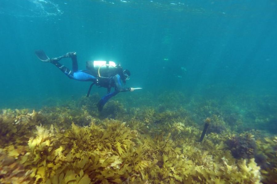
Golden Kelp (Ecklonia radiata); Photo Credit: Dr Paul Carnell
Bellarine Peninsula Saltmarsh
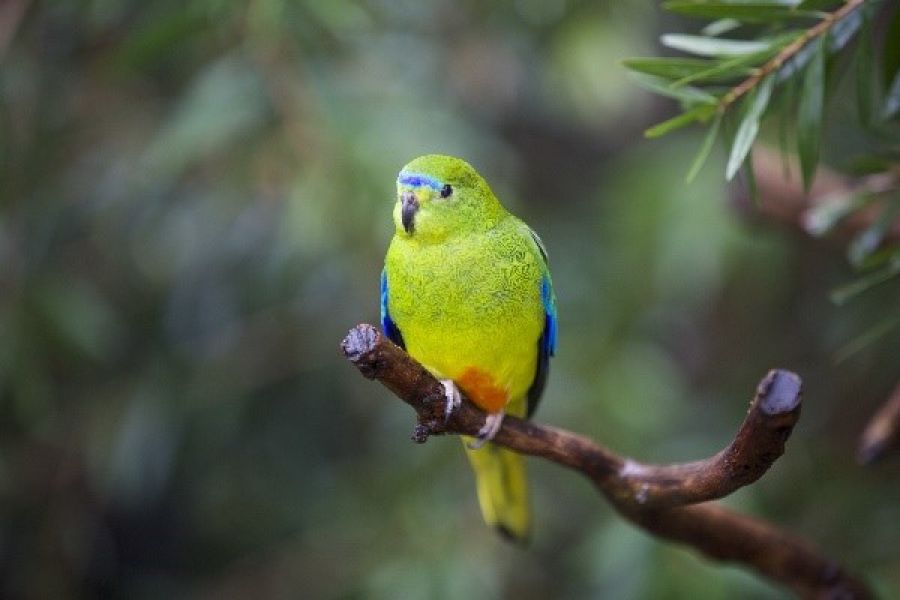
Orange-bellied Parrot (Neophema chrysogaster)
The Corangamite CMA project delivers on-ground actions to protect saltmarsh that provides multiple benefits for carbon storage, protection of threatened saltmarsh communities and protection of habitat significant to the Orange-bellied Parrot (OBP). Priority areas of saltmarsh habitat on the eastern shore of Lake Connewarre and bordering Swan Bay will be managed with site specific actions to achieve continuity of existing management plans. Site works will include reducing grazing and installing fencing to allow for effective management of stock and weed control to improve habitat condition. In addition, new management plans will be established for on-ground works at Swan Bay, focused on adaptation for the future migration of saltmarsh habitat, including fencing installation and removal of bunding.
Page last updated: 24/09/25