Citizen Scientists
Citizen scientists play an important role in the Victorian Coastal Monitoring Program (VCMP). Local communities are crucial in understanding how beaches respond during and after storm events. The VCMP team encourage members of the public to get involved and assist with the collection of data.
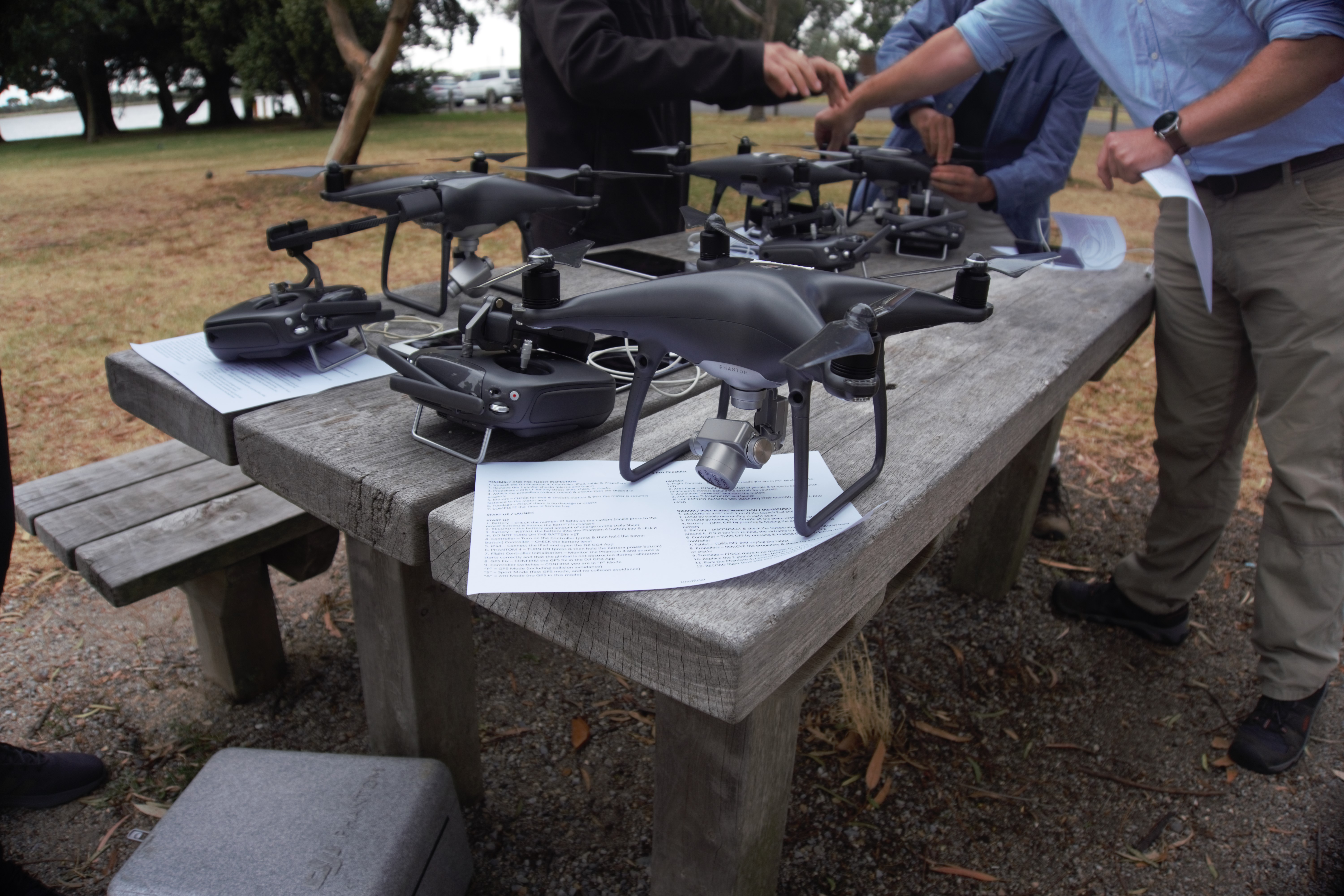
VCMP Citizen Science Drone Program
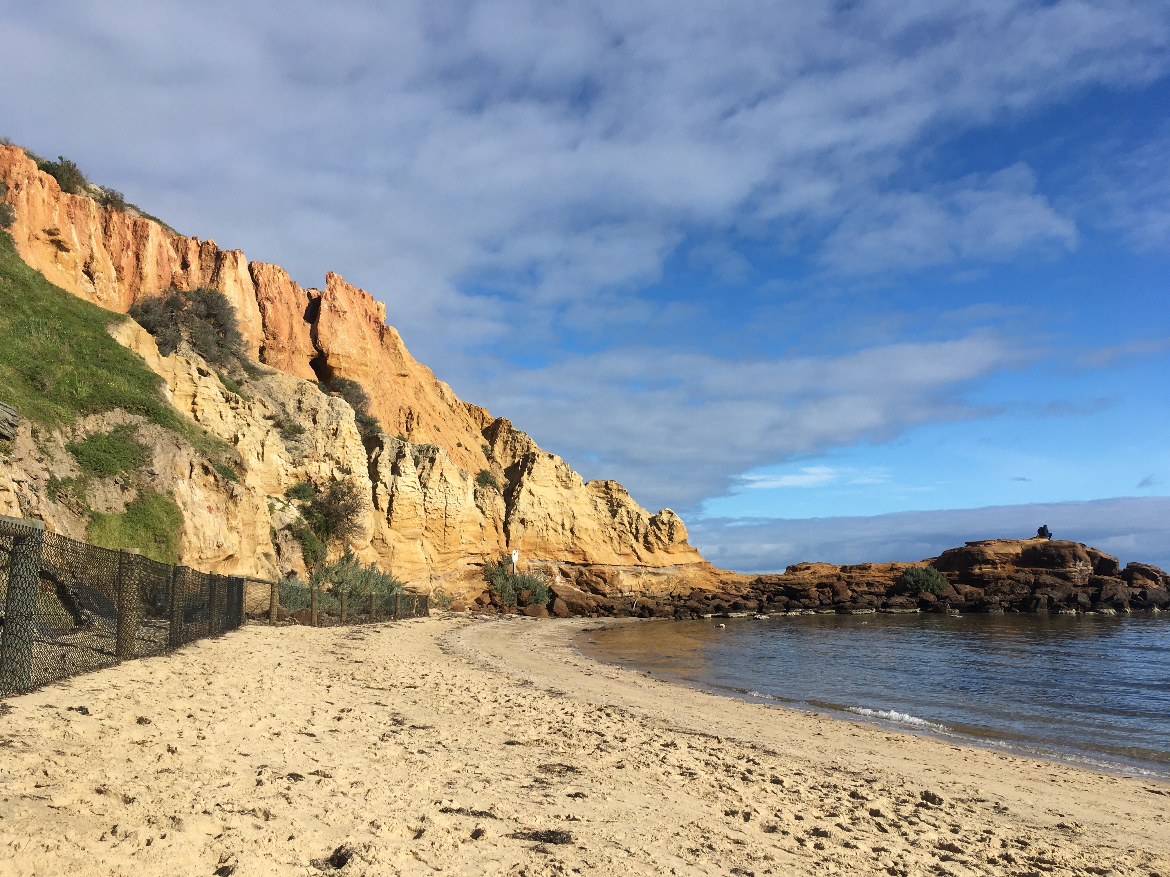
The VCMP Citizen Science Drone Program is a partnership between DEECA, Deakin University and the University of Melbourne, in collaboration with multiple volunteer groups, that empowers citizen scientists to conduct drone surveys along their local beaches across the Victorian coast. The program won the Victorian Marine and Coastal Council award for Innovative Citizen Science in 2020.
The volunteer groups are provided with appropriate training and equipment to assist with the collection of survey and research grade data. The groups survey their local beaches around every 6 weeks. This provides necessary data that could not be collected by the Science Team alone.
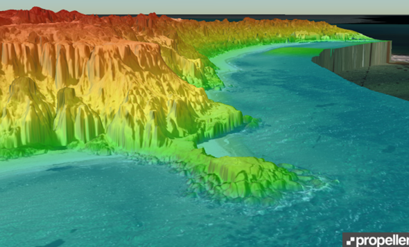
Data collected from the drones are uploaded and processed on PropellerAero.
More information can be found on Deakin's Victorian Coastal Monitoring Program - StoryMaps page.
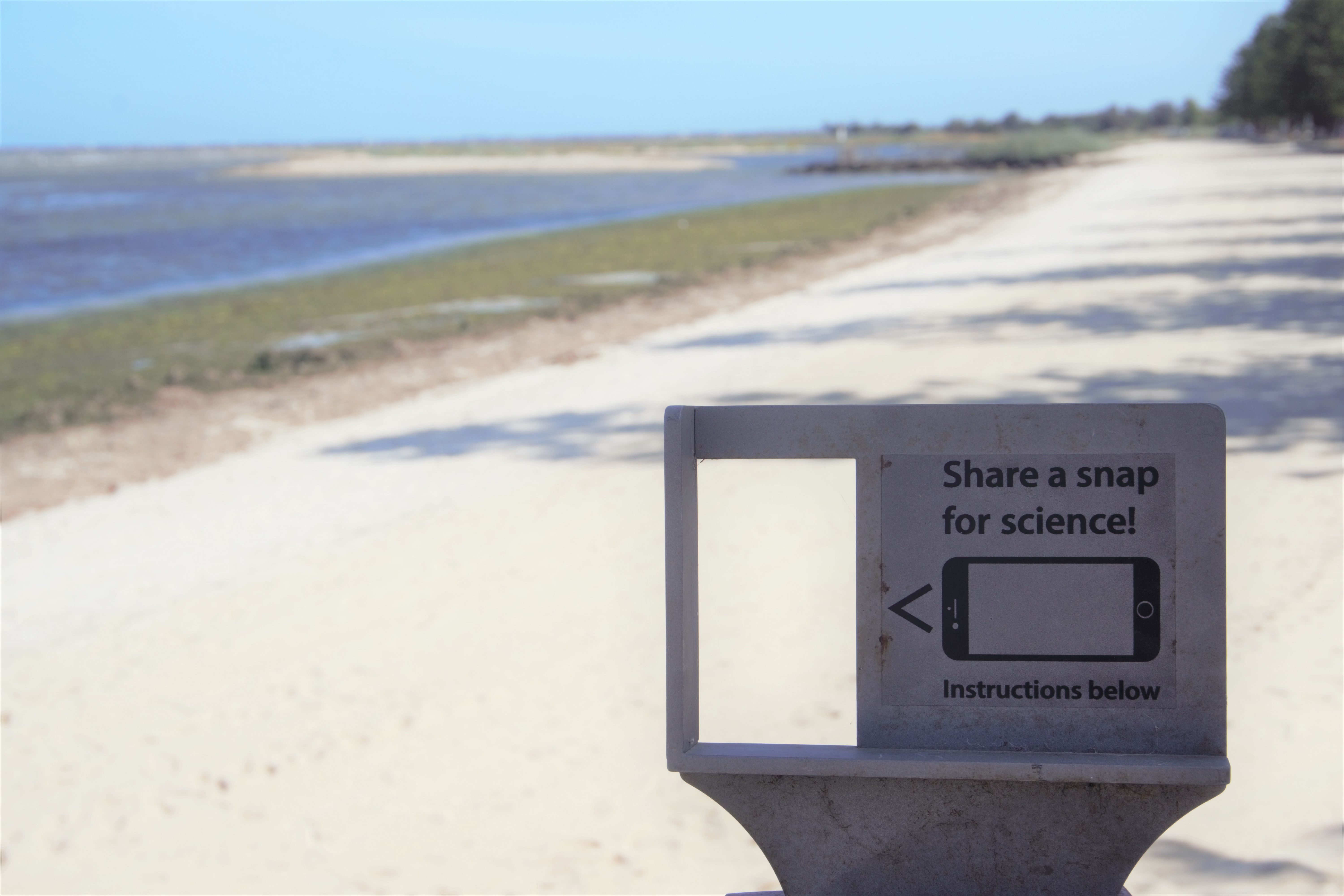
CoastSnap
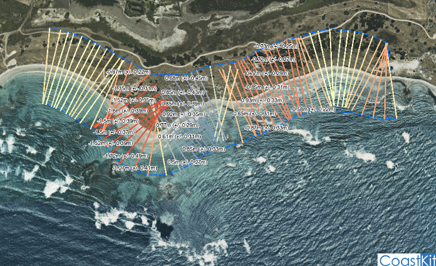
CoastSnap is a global citizen science project founded in 2017 by the UNSW Water Research Laboratory and the NSW Department of Planning, Industry and Environment. The core principle of the program relies on frequent photos being taken at the same location over a period of time. Stainless steel phone cradles are set up overlooking beaches at easily accessible locations. Community members can then follow instructions on the signs adjacent the cradles.
There are a number of CoastSnap stations along the Victorian coastline that have been installed with collaborative funding from DEECA, Melbourne University and local councils. The photos capture by members of the public are converted into critical coast data using a technique known as photogrammetry.
How to participate:
- Find a CoastSnap station near you on the CoastSnap site. Ensure you filter by ‘Method’ and select ‘Coastsnap Station’.
- At any of the CoastSnap stations, place your smart phone in the cradle, take a photo and upload via the CoastSnap App or social media using the station hashtag.
More information:
Harley, M.D., Kinsela, M.A., Sanchez-Garcia, E. and Vos, K. (2019) Shoreline change mapping using crowd-sourced smartphone images, Coastal Engineering, Vol. 150, 175-189.
Harley, M. D., & Kinsela, M. A. (2022). CoastSnap: A global citizen science program to monitor changing coastlines. Continental Shelf Research, 245, 104796.
Traditional Owners
The VCMP team have been working with Traditional Owner Groups to ensure they have the means to gather data regarding coastal changes on their own lands. The groups are supported and encouraged to undertake drone training so that they are able to monitor sites of significant cultural importance to aboriginal people.
This initiative supports aboriginal people to be at the centre of decision-making around the issues that directly affect their lives and aligns with DEECA's Pupangarli Marnmarnepu 'Owning Our Future' Aboriginal Self-Determination Reform Strategy.
Victorian Coastal Monitoring Program Newsletters
Latest issue
Issue 5 - March 2023 (PDF, 314.3 KB)
Subscribe
Subscribe to this newsletter
Unsubscribe
Unsubscribe from this newsletter
Past issues
You can also keep up-to-date with the latest marine and coastal news from DEECA by subscribing to the DEECA Marine and Coasts newsletter.
Page last updated: 20/05/23