The Victorian Coastal Monitoring Program (VCMP) runs, supports and funds many research projects. On this page you will find both projects we are currently working on and projects we have previously delivered.
Erosion Warning Indicators
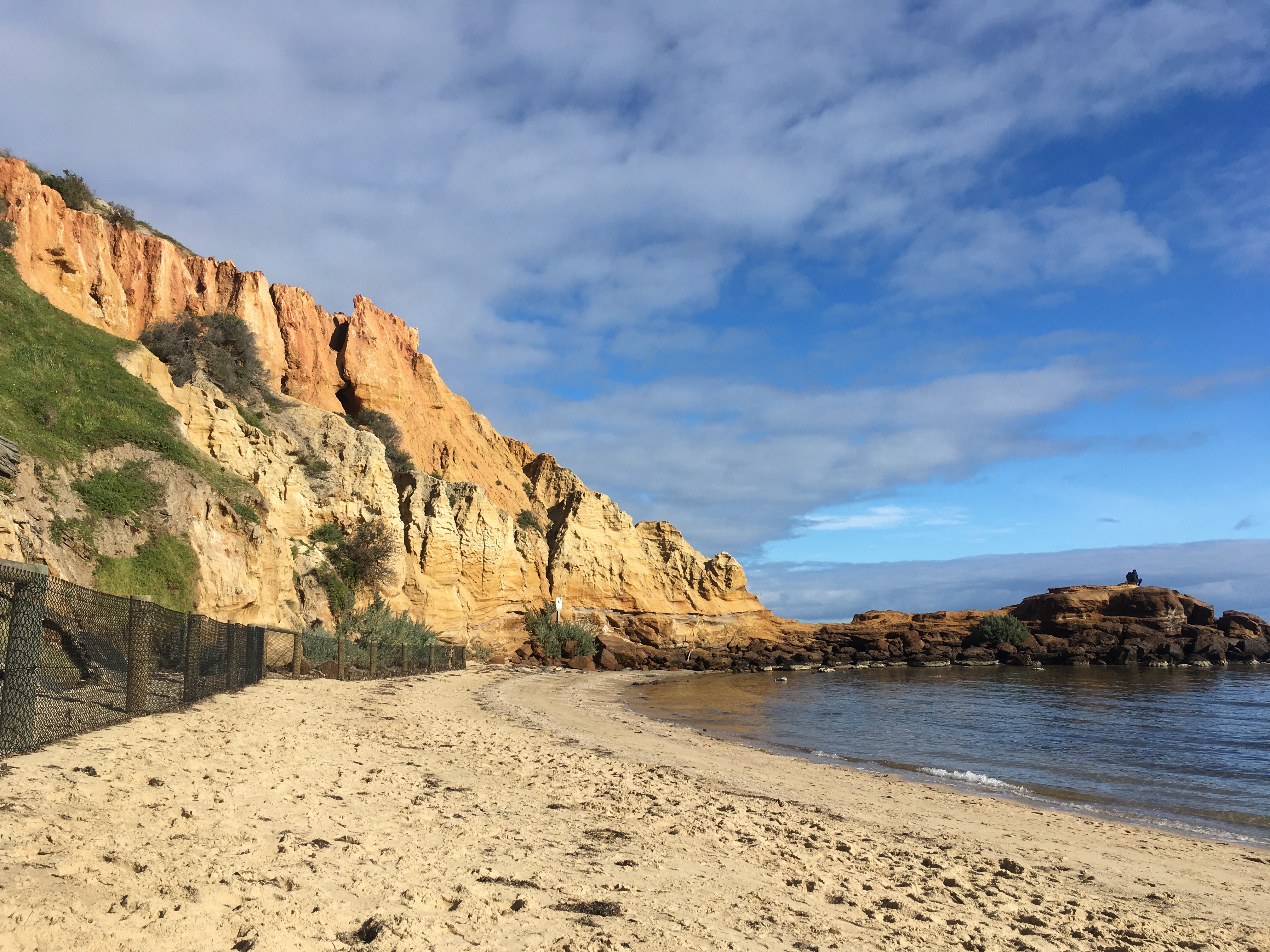
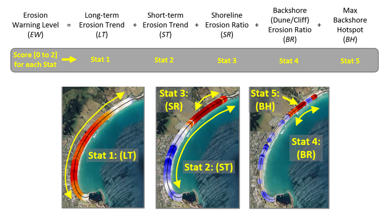
There are many ways to monitor coastal change yet there is no single metric that can assess all aspects of coastal erosion, e.g., short-term vs. long-term or broad-based vs. hotspot erosion.
To address this issue, the VCMP have developed a suite of Coastal Erosion Indicators (PDF, 18.3 MB), using drone and satellite data, to aid in coastal management, policy and planning. The Coastal Erosion Indicators are now available on CoastKit.
The Coastal OmniLine and OmniSites
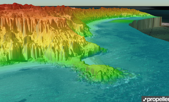
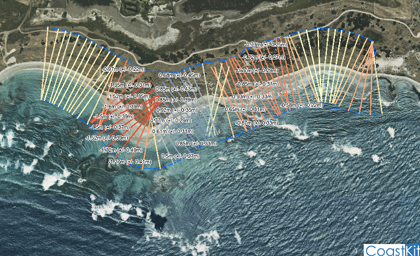
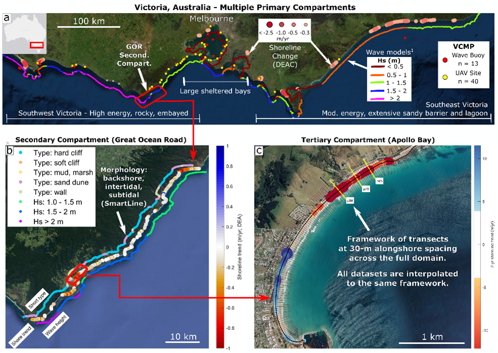
Modelling coastal hazards requires a wide array of data products, including shoreline monitoring (e.g., by drone, satellite, lidar), ocean dynamics (e.g., waves, tides), and geomorphology (e.g., coastal type, sediment size).
The VCMP are producing a data product, called the Coastal OmniLine that interpolates all available coastal data to a single set of shoreline transects, spanning the full extent of the Victorian coastline. The Coastal OmniLine can be used as a uniform basis for further coastal research and planning. Sections of the statewide line covering the VCMP drone monitoring locations, referred to as OmniSite datasets, can be viewed through CoastKit.
Sediment Mapping - Sources, Distribution and Availability
This project explores mapping sediment grain size and depth in Port Phillip Bay. A critical element of beach nourishment in Port Phillip Bay is understanding where sand is available, and how much is there.
At present there are:
- No comprehensive sediment maps for the Bay.
- No bay-wide estimates of sand available for nourishment.
This project will deliver:
- A sediment map for targeting sand renourishment sources with the Bay.
- Modelling results to determine if sand sources are sufficient for long-term maintenance of beaches (including with sea level rise).
Multi-Model Workflow for Assessing Beach Dynamics
This project focuses on the calibration and application of three different numerical modelling methods to better understand coastal processes on semi-sheltered urban beach system in Port Phillip Bay. The project is being run in collaboration with University of Melbourne, and environmental and engineering consultancy company, Tonkin + Taylor.
This project will:
- Develop models targeted to our planning needs, to improve how renourishments, other coastal projects and hazard assessments are implemented.
For more information, see Developing a multi-model workflow for assessing beach dynamics (PDF, 89.3 KB) abstract.

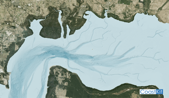
Port Phillip Bay Wave-Hydrodynamic Modelling
This project used hindcast sea state conditions to carry out long-term simulations of the hydrodynamic climate of Port Phillip Bay. The simulations were derived from a coupled high resolution unstructured grid modelling system that merges the 2D circulation model (SCHISM) with the spectral wind wave model (WWMIII). This projected is being delivered by University of Melbourne.
For more information, see the Improvement of Port Phillip Bay coupled hydrodynamic hindcast model (PDF, 62.5 KB) abstract.
Victorian Statewide Wave-Hydrodynamic Modelling
This state-of-the-art Victorian wave-hydrodynamic model used hindcast sea state conditions to carry out long-term simulations of the hydrodynamic climate of the Victorian coastline. Like the Port Phillip Bay model, the simulations were derived from a coupled high resolution unstructured grid modelling system that merges the 2D circulation model (SCHISM) with the spectral wind wave model (WWMIII).
This model enables the Victorian Government to ensure that all future coastal hazard and risk studies, from local to statewide scale, can apply the highest possible standard of oceanographic modelling. This will better inform decision making and optimise coastal adaptation, improve hazard reduction and increase coastal resilience.
The Victorian statewide wave-hydrodynamic model data can be accessed by contacting Datashare.
This projected was delivered by University of Melbourne.
![]() Li et al 2025_Assessing the effects of sea level rise on ocean waves and surge events along_OM.pdf
Li et al 2025_Assessing the effects of sea level rise on ocean waves and surge events along_OM.pdf

Seabed Mapping
Deakin University is using their mapping vessel, Yolla, to map and take samples of the seafloor off the Victorian coast.
This project will:
- Inform nearshore hydrodynamics.
- Result in maps that can be used to quantify the availability of offshore sediment supplies.
More information can be found on Deakin's Marine Mapping and Victorian Coastal Monitoring Program - StoryMaps pages.
Historical Research Projects
Previous research projects are listed below:
- UAV contribution to coastal compartments - Pucino et al. (PDF, 4.1 MB)
- Hyperspectral Remote Sensing of Coastal Morphodynamics - Pucino et al. (PDF, 3.5 MB)
- Shoreline fluxes in Lady Bay, Warrnambool: Sedimentation processes - Bhatt (PDF, 637.1 KB)
- Volumetric calculations using historical aerial photographic archive: moving beyond shoreline extraction in coastal Victoria - Carvalho et al. (PDF, 4.6 MB)
- Mobility of active coastal dune system in Victoria, Australia: An example from Cape Woolamai - Gao et al. (PDF, 1.9 MB)
- Coastal barrier evolution in the Gippsland region over the Last Interglacial and Holocene - Kennedy et al. (PDF, 2.2 MB)
- Quantifying historic erosion rates along Victoria’s Coastline - Konlechner et al. (PDF, 2.9 MB)
- Modern Dune Dynamics on the Inverloch Spit - McGuirk et al. (PDF, 3.1 MB)
- Predicting future geomorphological change along Victoria’s Coastline, using innovative numerical modelling techniques - Morris et al. (PDF, 3.1 MB)
- Coastal Compartment Modelling and Visualisation - Morris (PDF, 2.2 MB)
- Citizen Science UAVs for Monitoring Shoreline Change - Allan et al. (PDF, 1.3 MB)
- Citizen Science and UAVs: How to monitor the Victorian coast - Pucino et al. (PDF, 3.6 MB)
- Westernport Bay Coastal wetland geomorphology - Rogers and Saintilan (PDF, 6.1 MB)
- Waves + Hydro-Sed - Reef et al. (PDF, 3.8 MB)
- Coastal Acid Sulfate Soils - Wong (PDF, 3.3 MB)
More information can be found on Deakin's Victorian Coastal Monitoring Program - StoryMaps page.
Page last updated: 08/01/26