The VCMP Team has a vast array of coastal data available. For an overview of the types of data available, please see A Guide to VIC Coastal Data for DEECA Suppliers.
DEECA has two main data access portals:
Please contact us by sending an email to vcmp@delwp.vic.gov.au to request access to specific datasets.
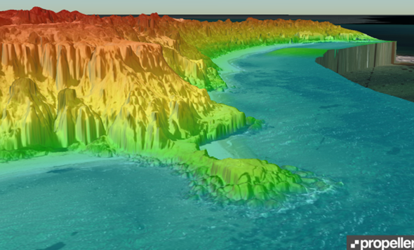
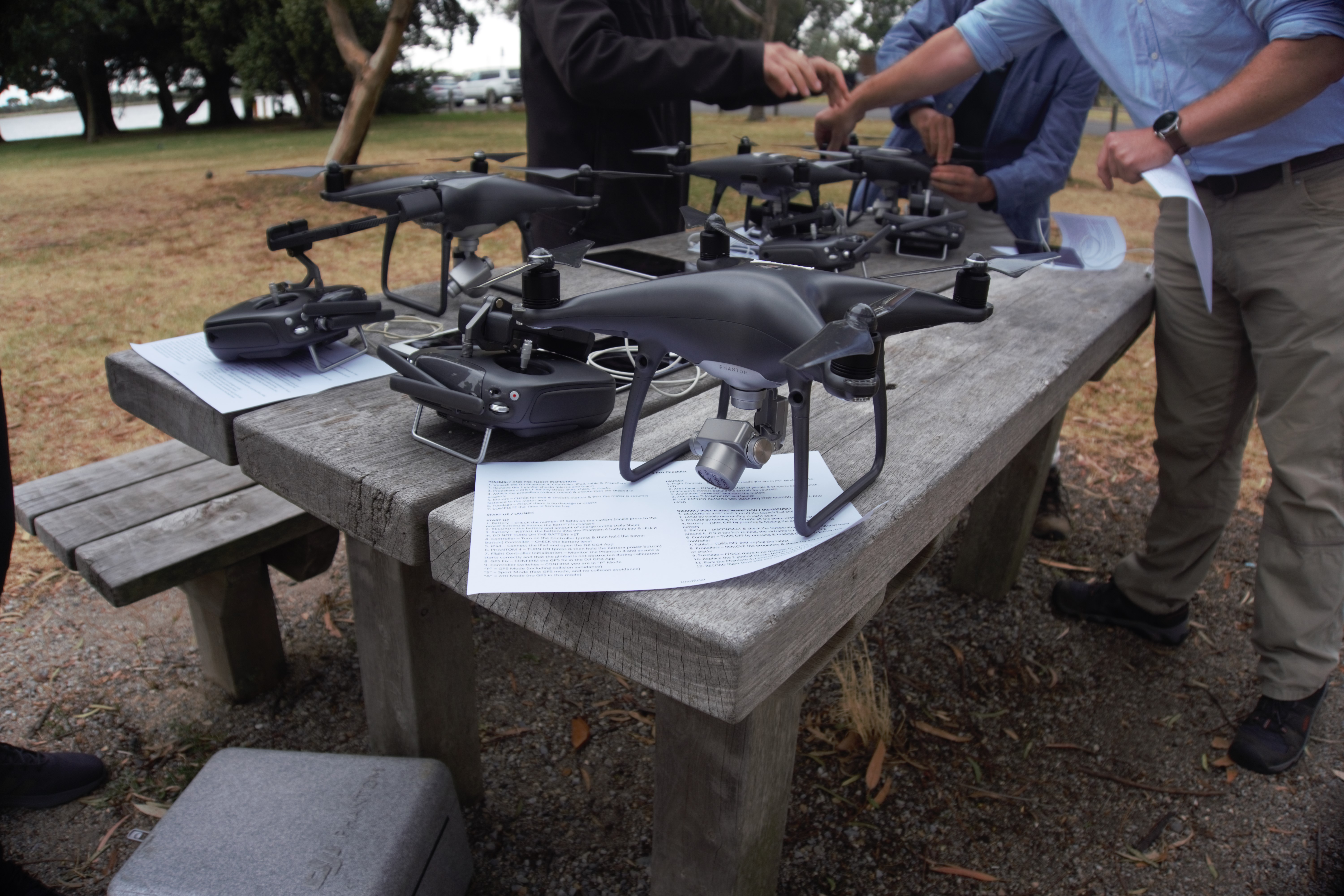
Drone Data
Access via Propeller Aero.
For view-only access use the following log in details:
- Username: vcmp@delwp.vic.gov.au
- Password: VCMP12345
For download access, contact us.
Lidar and Aerial Imagery
Access options:
- Lidar and Areil Imagery are available through DEECA's Coordinated Imagery Program.
- Access images of site locations through DEECA's Image Web Server (IWS).
- Access in GIS using Web Map Services (WMS)
- Vicmap Imagery & Elevation Coverage can be used to search for Lidar and Aerial Imagery
Victorian Coastal Digital Elevation Model (VCDEM)
Two version of the Victorian Coastal DEM are available:
- VCDEM(2017) - Available for download through the Australian Ocean Data Network (AODN). Search for "Victorian Coastal Digital Elevation Model"
- VCDEM(2021) - Available by contacting us.
Wave buoys
Live data and historical time series download data are available for download through VicWaves.
Tide gauges
Victorian tide gauge data is not currently available through the VCMP. However, we are looking to fill this data gap.
At present, we recommend accessing the Monthly Tide Gauge Statistics through the Bureau of Meteorology.
Wave +/- Hydro models
There are three models available:
- Victorian Statewide SCHISM / WWIII Model - For more information, see 'Research projects'.
- Port Phillip Bay SCHISM Model - For more information, see 'Hydrodynamic Climate of Port Phillip Bay'
- VIC WAVEWATCH III Model - For more information, see 'The wave climate of Bass Strait and South-East Australia'
The Victorian Statewide SCHISM / WWIII Model data is available through Datashare.
Coastal node statistics across the Port Phillip and Vic WaveWatch III model are viewable on CoastKit.
For access to coastal node data (mean statistics and time series), contact us.
Victorian Coastal Inundation Model
Two methods of access:
- DataShare - Search: 'Victorian Coastal Inundation'
- CoastKit (view-only access) - Select Coastal Hazard Assessment > Statewide Scaled Datasets > Storm Surge (STM) and Sea Level Rise (SLR)
Victorian Coastal Hazard Assessment 2017
Two methods of access:
- DataShare - Search: 'Victorian Coastal Hazard Assessment'
- CoastKit (view-only access) - Select Coastal Hazard Assessment > Statewide Scaled Datasets > Erosion Vulnerability > Victoria Consolidated CHA
Coastal Asset Management System (CAMS)
Three methods of access:
- DataShare - Search: 'Coastal Protection Structures'
- CoastKit (view-only access) - Select Coastal Assets and Infrastructure > Coastal Protection Structures
- Contact the VCMP Team and request the most recent version.
Local Coastal Hazard Studies
Two methods of access:
- CoastKit (view-only access) - Select Coastal Hazard Assessment > Local Study Data Sets (Limited sites available)
- Contact local authorities and project managers for individual sites. Contact the VCMP team to see if further information or contacts are available.
Satellite - Digital Earth Australia
Victorian Coastline data can be visualised and downloaded from Digital Earth Australian (DEA).
For more information:
Bishop-Taylor, R., Nanson, R., Sagar, S. and Lymburner, L., 2021. Mapping Australia's dynamic coastline at mean sea level using three decades of Landsat imagery. Remote Sensing of Environment, 267, p.112734.
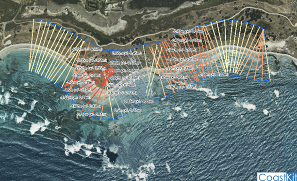
Coastal OmniLine and OmnSites
Two methods of access:
CoastKit (view-only access) - Select Victorian Monitoring Program > Shoreline Trends > Click on a transect
Contact us and request OmniLine or OmniSite data
Page last updated: 08/01/26