Project context
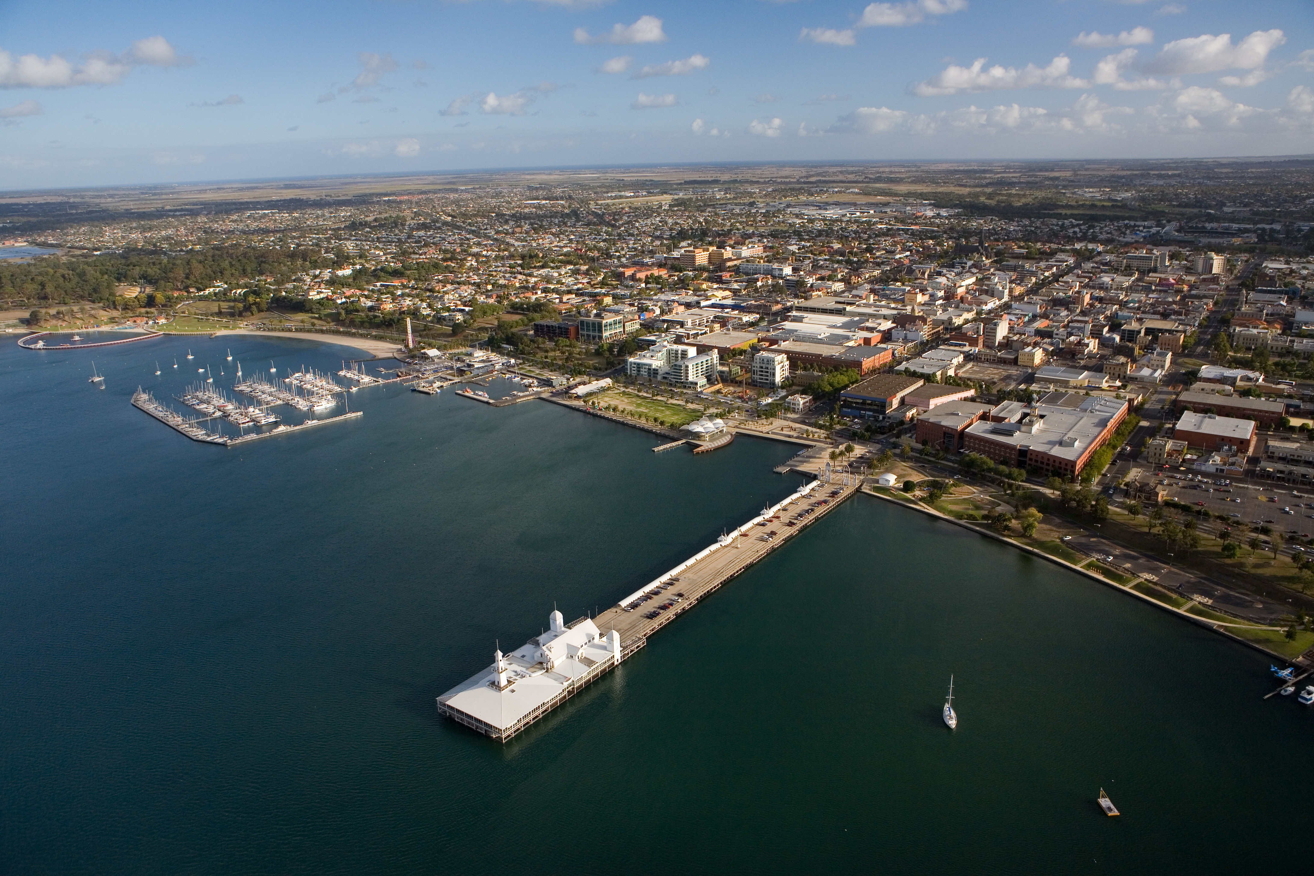
Port Phillip Bay’s coastal areas are home to 1.3 million Victorians. A diverse and distinct landscape, the Bay and its coast is a major drawcard for living in the region. It also supports unique and special marine and coastal ecosystems, habitats and species.
Natural coastal processes like erosion and inundation shape our coasts. These processes can sometimes become a hazard when they impact on coastal values and uses. With a changing climate and rising sea levels, we’re expecting more impacts from coastal hazards around Port Phillip Bay. We need to plan for the impacts they will have on what we value.
The technical work
To proactively plan for and manage future changes to the Port Phillip Bay coastline, we’re delivering the Port Phillip Bay Coastal Hazard Assessment (PPBCHA). Building upon a range of existing models and studies, this project combines the latest science, monitoring and technical assessments. It looks to understand more about the complex coastal processes of Port Phillip Bay.
The PPBCHA has used sophisticated coastal modelling and analysis to further our understanding. Bay-wide models produced extensive data sets which have been used in estimating coastal hazards.
The coastal hazards examined in the PPBCHA are coastal inundation, coastal erosion and changes in groundwater salinity and depth.
Coastal inundation
Coastal inundation is flooding of low-lying land by seawater.
Some lower lying land around Port Phillip Bay is prone to coastal flooding. With sea level rise, areas flooded by the sea during storms may become bigger. We have looked at increasing tidal areas due to rising sea levels, and where we may experience flooding when we have storms.
- Storm tide inundation: temporary event-based inundation
- Permanent inundation: regular or persistent inundation by the regular tidal cycle
Coastal erosion
Coastal erosion is the process of winds, waves and coastal currents shifting sediment, for example sand, silt, or soil away from a localised area of the shoreline.
Areas around Port Phillip Bay may be prone to coastal erosion. With sea levels rising, some of our shorelines are moving. Higher water levels, and bigger storms also mean waves can reach further onshore. This will likely cause more erosion.
We have looked at:
- Short-term erosion: Event-based erosion of sediment (storm bite) and recovery
- Long-term erosion (recession): Progressive retreat of shoreline position over time
Changes in groundwater salinity and depth
Groundwater systems may see changes due to rising sea levels. This includes movement of saltwater into freshwater aquifers / groundwater.
To understand groundwater hazards in the regions around Port Phillip Bay, we looked at:
- changing water table depth/levels
- shallow groundwater becoming surface water
- changing groundwater quality (such as salinity).
The outcomes of this work allow us to better understand the region’s coastal hazards and possible implications for our local communities, now and into the future. These results provide the foundation for more in-depth, site specific assessments and adaptation planning.
Read the final technical reports:
PPBCHA Tertiary compartments final report (PDF, 2.1 MB)
PPBCHA Erosion final report (PDF, 20.8 MB)
PPBCHA Follow up project 2023 methodology issue 2 (PDF, 1.3 MB)
PPBCHA Inundation and groundwater final report (PDF, 39.2 MB)
Port Philip Bay erosion hazard assessment data and literature review report (PDF, 4.8 MB)
Port Phillip Bay erosion hazard methodology report
(PDF, 4.0 MB)
Find out more about the assessments via the technical summaries
Summary #1: Study region (PDF, 1.4 MB)
Summary #2: Study design (PDF, 1.2 MB)
Summary #3: Coastal modelling (PDF, 1.1 MB)
Summary #4: Inundation hazard assessment (PDF, 2.9 MB)
Summary #5: Groundwater hazard assessment (PDF, 2.5 MB)
Summary #6: Erosion hazard assessment (PDF, 1.9 MB)
Summary #7: Applying the coastal hazard assessment
(PDF, 2.0 MB)
Hazard maps
A key output from the PPBCHA are coastal hazard maps.
The PPBCHA has produced Bay-wide and location-based hazard maps showing the hazard extents for each type of coastal hazard. This is for a range of hazard types, storm events and sea level rise scenarios. Hazard maps highlight areas potentially impacted by different coastal hazard types. This is if we make no changes to how we manage these areas.
The PPBCHA and its mapping allows us to think about:
- what and where the hazards are
- when hazards may occur
- how they change over time
This means we can better plan and develop appropriate responses to manage current and future coastal hazards.
Area/s being in a hazards zone, doesn’t necessarily mean they need management /action. Land and asset managers need to look at the values, uses and infrastructure within these hazard areas and consider the implications.
You can also view the data on CoastKit
The hazard layers can be found on DEECA’s Data Share portal
- Inundation_depth_0m_SLR_BayWide (PDF, 9.3 MB)
- Inundation_depth_0m_SLR_SubArea1 (PDF, 7.3 MB)
- Inundation_depth_0m_SLR_SubArea2 (PDF, 9.6 MB)
- Inundation_depth_0m_SLR_SubArea3 (PDF, 7.6 MB)
- Inundation_depth_0m_SLR_SubArea4 (PDF, 9.3 MB)
- Inundation_depth_0m_SLR_SubArea5 (PDF, 9.2 MB)
- Inundation_depth_0m_SLR_SubArea6 (PDF, 9.3 MB)
- Inundation_depth_0m_SLR_SubArea7 (PDF, 5.1 MB)
- Inundation_depth_08m_SLR_BayWide (PDF, 9.3 MB)
- Inundation_depth_08m_SLR_SubArea1 (PDF, 7.2 MB)
- Inundation_depth_08m_SLR_SubArea2 (PDF, 9.6 MB)
- Inundation_depth_08m_SLR_SubArea3 (PDF, 7.5 MB)
- Inundation_depth_08m_SLR_SubArea4 (PDF, 9.3 MB)
- Inundation_depth_08m_SLR_SubArea5 (PDF, 9.2 MB)
- Inundation_depth_08m_SLR_SubArea6 (PDF, 9.3 MB)
- Inundation_depth_08m_SLR_SubArea7 (PDF, 5.1 MB)
- Inundation_extent_1_AEP_0m_to_1_1m_SLR_BayWide (PDF, 9.3 MB)
- Inundation_extent_1_AEP_0m_to_1_1m_SLR_SubArea1 (PDF, 7.2 MB)
- Inundation_extent_1_AEP_0m_to_1_1m_SLR_SubArea2 (PDF, 9.6 MB)
- Inundation_extent_1_AEP_0m_to_1_1m_SLR_SubArea3 (PDF, 7.5 MB)
- Inundation_extent_1_AEP_0m_to_1_1m_SLR_SubArea4 (PDF, 9.3 MB)
- Inundation_extent_1_AEP_0m_to_1_1m_SLR_SubArea5 (PDF, 9.2 MB)
- Inundation_extent_1_AEP_0m_to_1_1m_SLR_SubArea6 (PDF, 9.4 MB)
- Inundation_extent_1_AEP_0m_to_1_1m_SLR_SubArea7 (PDF, 5.1 MB)
- Inundation_extent_1_AEP_0m_to_1_1m_SLR_withRainfall_BayWide (PDF, 9.7 MB)
- Inundation_extent_1_AEP_0m_to_1_1m_SLR_withRainfall_SubArea1 (PDF, 7.4 MB)
- Inundation_extent_1_AEP_0m_to_1_1m_SLR_withRainfall_SubArea2 (PDF, 10.2 MB)
- Inundation_extent_1_AEP_0m_to_1_1m_SLR_withRainfall_SubArea3 (PDF, 8.6 MB)
- Inundation_extent_1_AEP_0m_to_1_1m_SLR_withRainfall_SubArea4 (PDF, 10.2 MB)
- Inundation_extent_1_AEP_0m_to_1_1m_SLR_withRainfall_SubArea5 (PDF, 10.0 MB)
- Inundation_extent_1_AEP_0m_to_1_1m_SLR_withRainfall_SubArea6 (PDF, 9.7 MB)
- Inundation_extent_1_AEP_0m_to_1_1m_SLR_withRainfall_SubArea7 (PDF, 5.2 MB)
- Erosion_extent_0m_SLR_ByAEP_BayWide (PDF, 16.6 MB)
- Erosion_extent_0m_SLR_ByAEP_SubArea1 (PDF, 14.7 MB)
- Erosion_extent_0m_SLR_ByAEP_SubArea2 (PDF, 14.7 MB)
- Erosion_extent_0m_SLR_ByAEP_SubArea3 (PDF, 11.4 MB)
- Erosion_extent_0m_SLR_ByAEP_SubArea4 (PDF, 13.8 MB)
- Erosion_extent_0m_SLR_ByAEP_SubArea5 (PDF, 14.1 MB)
- Erosion_extent_0m_SLR_ByAEP_SubArea6 (PDF, 13.8 MB)
- Erosion_extent_0m_SLR_ByAEP_SubArea7 (PDF, 7.3 MB)
- Erosion_extent_1_AEP_0m_to_1_1m_SLR_BayWide (PDF, 16.7 MB)
- Erosion_extent_1_AEP_0m_to_1_1m_SLR_SubArea1 (PDF, 9.5 MB)
- Erosion_extent_1_AEP_0m_to_1_1m_SLR_SubArea2 (PDF, 13.1 MB)
- Erosion_extent_1_AEP_0m_to_1_1m_SLR_SubArea3 (PDF, 10.1 MB)
- Erosion_extent_1_AEP_0m_to_1_1m_SLR_SubArea4 (PDF, 12.2 MB)
- Erosion_extent_1_AEP_0m_to_1_1m_SLR_SubArea5 (PDF, 12.4 MB)
- Erosion_extent_1_AEP_0m_to_1_1m_SLR_SubArea6 (PDF, 12.2 MB)
- Erosion_extent_1_AEP_0m_to_1_1m_SLR_SubArea7 (PDF, 6.6 MB)
- Erosion_extent_08m_SLR_ByAEP_BayWide (PDF, 16.7 MB)
- Erosion_extent_08m_SLR_ByAEP_SubArea1 (PDF, 10.6 MB)
- Erosion_extent_08m_SLR_ByAEP_SubArea2 (PDF, 14.7 MB)
- Erosion_extent_08m_SLR_ByAEP_SubArea3 (PDF, 11.4 MB)
- Erosion_extent_08m_SLR_ByAEP_SubArea4 (PDF, 13.8 MB)
- Erosion_extent_08m_SLR_ByAEP_SubArea5 (PDF, 14.1 MB)
- Erosion_extent_08m_SLR_ByAEP_SubArea6 (PDF, 13.9 MB)
- Erosion_extent_08m_SLR_ByAEP_SubArea7 (PDF, 7.3 MB)
- Groundwater_depth_0m_SLR_BayWide (PDF, 7.9 MB)
- Groundwater_depth_0m_SLR_SubArea1 (PDF, 5.4 MB)
- Groundwater_depth_0m_SLR_SubArea2 (PDF, 6.4 MB)
- Groundwater_depth_0m_SLR_SubArea3 (PDF, 5.3 MB)
- Groundwater_depth_0m_SLR_SubArea4 (PDF, 6.9 MB)
- Groundwater_depth_0m_SLR_SubArea5 (PDF, 6.8 MB)
- Groundwater_depth_0m_SLR_SubArea6 (PDF, 6.7 MB)
- Groundwater_depth_0m_SLR_SubArea7 (PDF, 4.2 MB)
- Groundwater_depth_08m_SLR_BayWide (PDF, 7.9 MB)
- Groundwater_depth_08m_SLR_SubArea1 (PDF, 5.6 MB)
- Groundwater_depth_08m_SLR_SubArea2 (PDF, 6.5 MB)
- Groundwater_depth_08m_SLR_SubArea3 (PDF, 5.3 MB)
- Groundwater_depth_08m_SLR_SubArea4 (PDF, 6.9 MB)
- Groundwater_depth_08m_SLR_SubArea5 (PDF, 6.8 MB)
- Groundwater_depth_08m_SLR_SubArea6 (PDF, 6.7 MB)
- Groundwater_depth_08m_SLR_SubArea7 (PDF, 4.3 MB)
- Groundwater_depth_shallow_0m_to_08m_SLR_BayWide (PDF, 9.7 MB)
- Groundwater_depth_shallow_0m_to_08m_SLR_SubArea1 (PDF, 7.1 MB)
- Groundwater_depth_shallow_0m_to_08m_SLR_SubArea2 (PDF, 8.4 MB)
- Groundwater_depth_shallow_0m_to_08m_SLR_SubArea3 (PDF, 5.8 MB)
- Groundwater_depth_shallow_0m_to_08m_SLR_SubArea4 (PDF, 8.4 MB)
- Groundwater_depth_shallow_0m_to_08m_SLR_SubArea5 (PDF, 8.1 MB)
- Groundwater_depth_shallow_0m_to_08m_SLR_SubArea6 (PDF, 9.6 MB)
- Groundwater_depth_shallow_0m_to_08m_SLR_SubArea7 (PDF, 5.4 MB)
- PermanentInundation_extent_05m_to_2m_AHD_BayWide (PDF, 16.0 MB)
- PermanentInundation_extent_05m_to_2m_AHD_SubArea1 (PDF, 9.1 MB)
- PermanentInundation_extent_05m_to_2m_AHD_SubArea2 (PDF, 14.0 MB)
- PermanentInundation_extent_05m_to_2m_AHD_SubArea3 (PDF, 10.8 MB)
- PermanentInundation_extent_05m_to_2m_AHD_SubArea4 (PDF, 13.2 MB)
- PermanentInundation_extent_05m_to_2m_AHD_SubArea5 (PDF, 13.7 MB)
- PermanentInundation_extent_05m_to_2m_AHD_SubArea6 (PDF, 13.6 MB)
- PermanentInundation_extent_05m_to_2m_AHD_SubArea7 (PDF, 6.6 MB)
Building capacity
Many agencies are responsible for managing coastal and marine areas around the Bay. We’ve also been working closely with coastal land managers and other key stakeholders as part of the PPBCHA. They have an important role using the assessment findings in making decisions on management of their local areas, especially in the longer-term.
Sharing this knowledge and discussing its implications with communities is also key to developing a long-term plan to manage important places, assets and other values in the future. This engagement allows community perspectives and aspirations to be reflected in the ways that we adapt to hazard risk and increase our resilience at a local-scale.
The resources below are available to support delivery partners in delivering successful hazard and adaptation engagement programs.
Reference #1: Wave tank (PDF, 490.1 KB)
Reference #2: Coastal timelines (PDF, 737.3 KB)
Reference #3: Community popup (PDF, 554.6 KB)
Reference #4: Community workshop (PDF, 592.2 KB)
Reference #5: Targeted interviews (PDF, 363.6 KB)
Reference #6: Communications toolkit (PDF, 448.8 KB)
Reference #7: Internal engagement (PDF, 404.0 KB)
Reference #8: Stakeholder briefings (PDF, 426.2 KB)
Reference #9: Interagency engagement (PDF, 483.3 KB)
What comes next
The PPBCHA modelling and analyses give us a regional perspective of coastal processes and potential hazard areas around the Bay. This is for a range of hazard types, storm events and sea level rise scenarios.
This work enables us to proactively plan our response to current and future hazards.
The PPBCHA maps and assessment findings enable us to progress adaptation planning and determine where to focus our efforts next. This may include further analysis and local-scale studies to aid decision-making. We can build upon this regional-scale hazard knowledge with:
- exposure assessments – what things (values, uses, infrastructure) are within hazard prone areas (exposed)
- vulnerability and risk assessments – what is the impact (consequence) of coastal hazard exposure on these things
- economics assessments – what are the costs/ economic implications of coastal hazard damages and/or losses
- adaptation planning – what are the range of actions available to manage current and future coastal hazard risks.
Page last updated: 28/03/24