Progres 2019-2020
Details on all activities, including annual activity updates can be found on CoastKit in the EMP theme.
Of the 191 activities currently listed in the Delivery Plan, 95 have been completed. 128 of the current listed activities listed in the Delivery Plan are funded by Coastcare and the Port Phillip Bay Fund community grant programs.
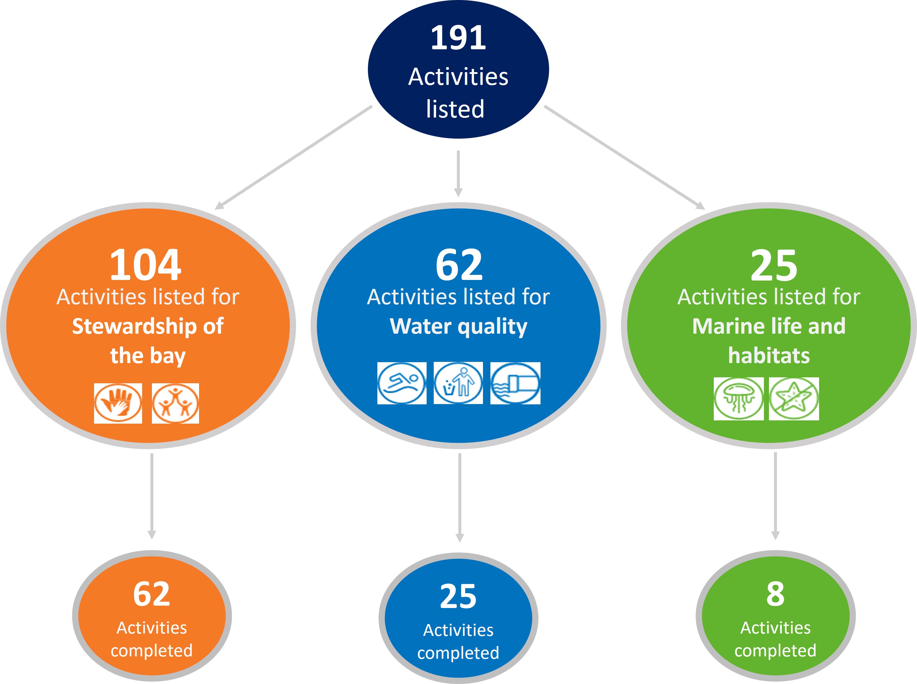
The activities completed to date have enhanced knowledge of the Port Phillip Bay environment, contributed to the implementation of policy and upgraded infrastructure. The image below showcases some of the collective achievements of the EMP activities completed in 2017-2020.
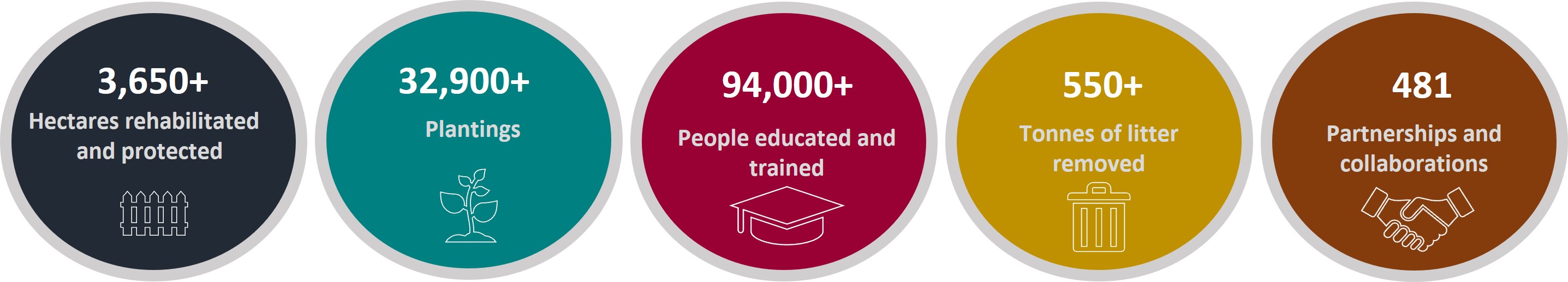
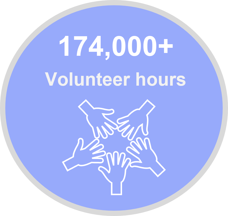
The end of June 2020 has seen an estimated investment of $19,344,665 towards implementing the EMP activities. In addition, significant in-kind contributions have been made by the many organisations contributing to the ongoing health and resilience of the Bay. These in-kind contributions include 174,089 volunteer hours, 36,945 staff hours, $4,137,780 of cash, and $4,568,025 of other in-kind contributions, such as equipment and transport.
The chart below breaks down the value of the investment, volunteer time, in-kind cash and other in-kind contributions against each of the EMP’s 3 goals.
The COVID-19 pandemic has had serious implications for project delivery world wide. As a result, the scheduled completion dates and actual completion dates may vary as a number of activities have been extended.
In 2020 the Environmental Management Plan’s (EMP) data management processes were updated. A database was created to store activity details, locations, annual updates, and achievement metrics. The database was then connected to DEECA’s new mapping portal, CoastKit (see the Case studies section for a short case study and user guide) and a new EMP theme was created.
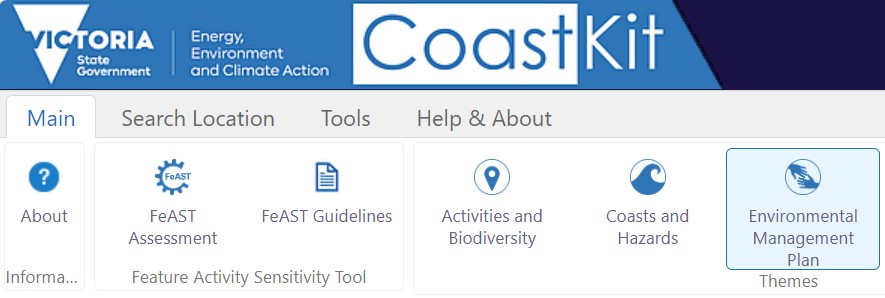
The EMP theme on CoastKit, by clicking on the EMP button as shown below.
The new EMP theme:
Supports data driven decision making during annual revisions of the Delivery Plan
- Visualises management activity coverage according to the EMP framework
- Displays the Delivery Plan and Annual Reports in an interactive manner
- Streamlines consolidation of outcome metrics for the 5-yearly evaluations and Annual Reports.
The Delivery Plan outlines funded activities across government, industry and the community, that align with the objectives and priorities of the Environmental Management Plan (EMP). These will be progressively achieved with new activities identified and added over the EMP’s 10-year implementation.
CoastKit contains the details of all activities listed in the Delivery Plan.
Case studies 2019-2020
The case studies provided by various organisations are activities listed in the 2020 Delivery plan.
Activity name: Caring for Our Bays – Cultural Connections and Businesses
Activity reference number: 1.1.002.AC and 2.1.001.AE
Strategic lead: Bellarine Catchment Network
The Caring for our Bays (CFOB) program addresses the increasing threat of plastic and human impacts on Corio Bay and Port Phillip Bay in the Geelong and Bellarine region. CFOB is an initiative of the Bellarine Catchment Network, a not-for-profit organisation comprised of representatives from key government and non-government catchment and coastal organisations, with an integrated catchment management focus.
Through the support of the Port Phillip Bay Fund CFOB has gained huge momentum and now involves numerous projects assisting community, school, youth and business in taking an active role in caring for their Bay.
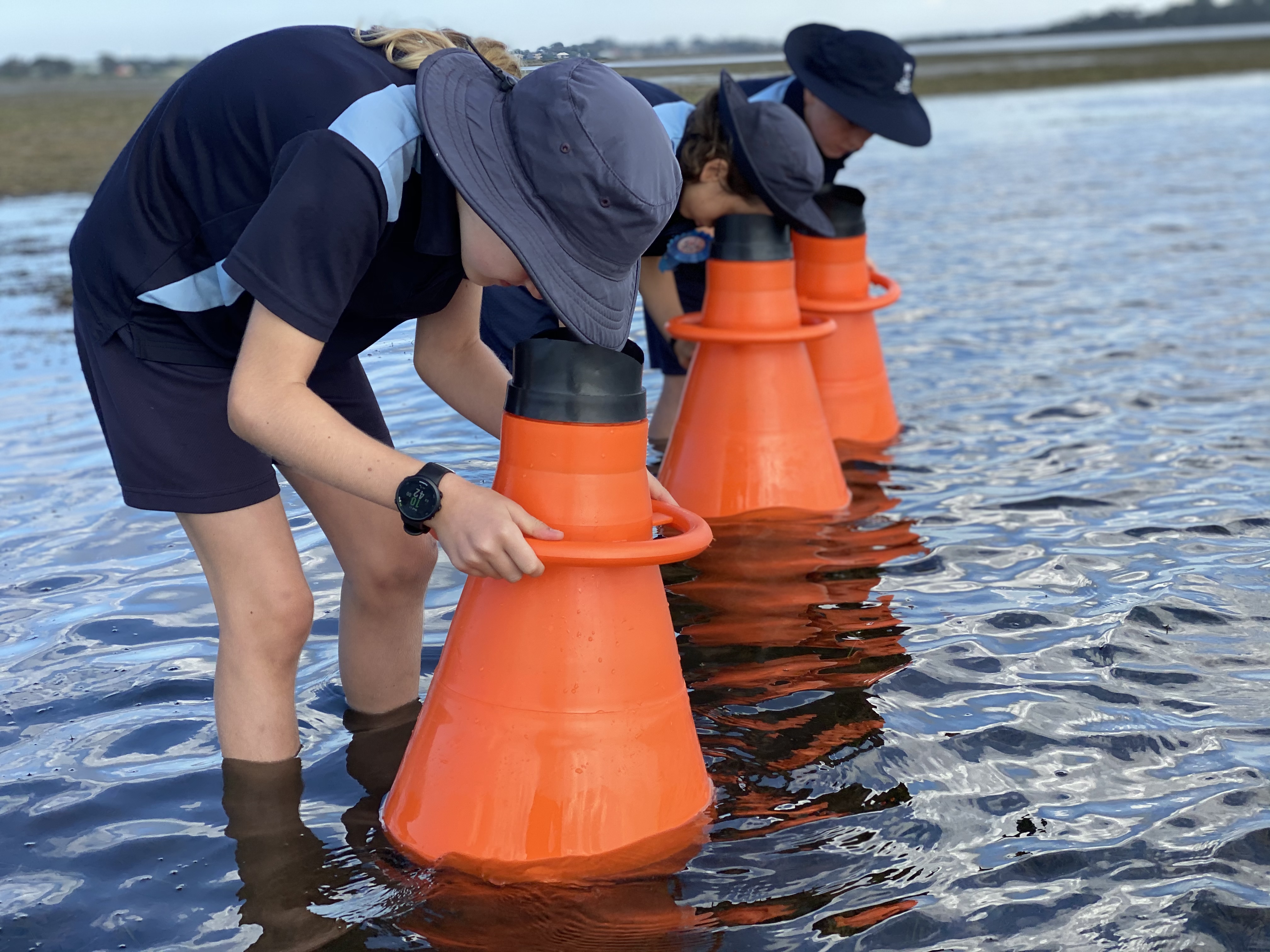
The Aquascope in action, image credit: Bellarine Catchment Network
The 2019-2020 CFOB Cultural Connections program worked with Wadawarrung Traditional Owners and other cultural groups within the Geelong and Bellarine region to increase understanding of cultural values and connection to Coast and Port Phillip Bay. The creation of a mobile application to showcase the CFOB Hero species highlighting indigenous values and cultural connections to the Bays was a key outcome of this project.
The application was developed in partnership with Wadawurrung and creates a legacy in delivering increased cultural awareness and education throughout the region. Environmental education resources, ‘Aquascope Cultural Shoreline Edventures’ and ‘Aquatic Cultural Bay Edventures’, were developed to immerse students, community and corporations in hands on cultural awareness activities.
Activity name: Litter baseline assessment and reporting
Activity reference number: 4.1.001.AA and 4.1.001.AB
Strategic lead: Department of Energy, Environment and Climate Action
LitterWatch Victoria is an online litter portal to manage and view publicly accessible litter datasets. The project was developed by DEECA and Federation University with support from Sustainability Victoria and in collaboration with community groups around Port Phillip Bay actively involved in litter data collection and clean up. These were the Port Phillip EcoCentre, Beach Patrol, Love Our Streets, and the Bellarine Catchment Network.
While the outcome of LitterWatch will be improved data collection that can be used to make decisions and set policy, the key focus has been on how to best support the groups collecting the data. To learn more about LitterWatch visit litterwatchvictoria.org.au.
Activity name: CoastKit Knowledge Management System
Activity reference number: 6.2.001.AC
Strategic lead: Department of Energy, Environment and Climate Action
As part of the Marine Knowledge Framework, DEECA have been developing a new mapping portal CoastKit. The platform was launched in November 2020 and acts as a central hub for Victoria’s marine and coastal information and allows members of the public to freely access, visualise and interact with state-wide datasets.
For the first time users from the community will have the opportunity to display and overlap layers from an extensive inventory to assist with policy making, reporting and planning decisions. New and notable layers include:
- Coastal erosion vulnerability ratings
- Natural, ecological and biodiversity values
- Beach safety rating, geology, hydrodynamics and administration
- Boating and coastal infrastructure
- Management and protected areas
- Marine pressures and activities
- Seafloor habitat mapping and biotope classification
- Port Phillip Bay Environmental Management Plan 2017-2027 activities
- Victorian Coastal Monitoring Program outputs
- Geobibliography: Geographical presentation of scientific research records for Victoria.
Explore historic and current scientific datasets, academic studies and imagery, video footage, real time wave buoy data, sea level rise scenarios and marine species assemblages. Structured around five data themes users can filter and search for data, download, zoom and pan around the map, identify and select features and create printable pdf maps.
Page last updated: 30/10/25