Progress 2022-2023
Details on all activities, including annual activity updates can be found on CoastKit at mapshare.vic.gov.au/coastkit in the EMP theme.
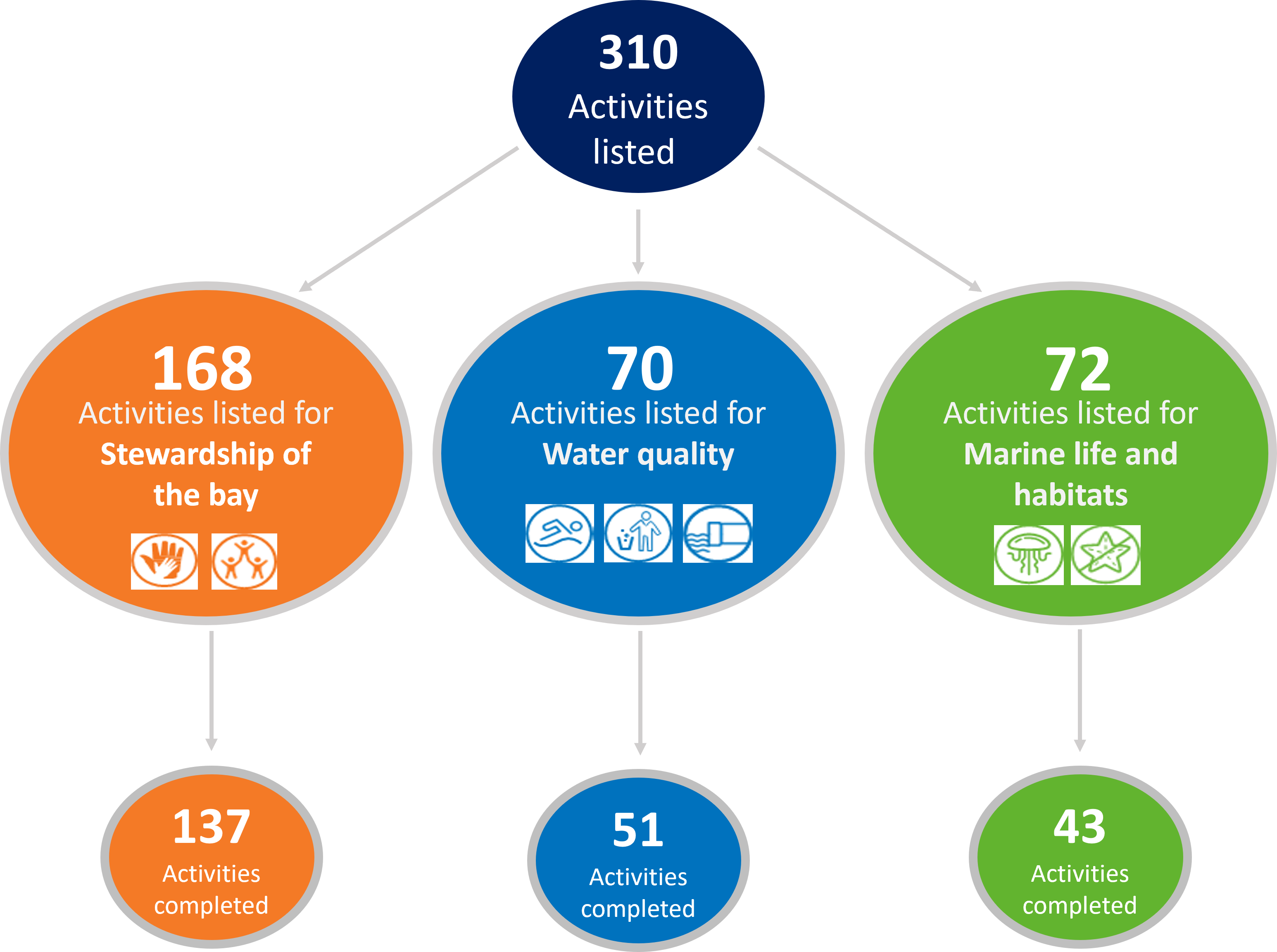
Of the 310 activities currently listed in the Delivery Plan, 231 have been completed. Many of the activities listed in the Delivery Plan are funded by Coastcare and the Port Phillip Bay Fund community grants.

The activities completed to date have enhanced knowledge of the Port Phillip Bay environment, contributed to the implementation of policy and upgraded infrastructure. The figure below showcases some of the collective achievements of the EMP activities completed in 2017-2023.
![]()
The End of June 2023 has seen an estimated investment of over $160,000,000 towards implementing the EMP activities. In addition, significant in-kind contributions have been made by the many organisations contributing to the ongoing health and resilience of the Bay. These in-kind contributions include over 905,000 volunteer hours, almost 790,000 staff hours, more than $4,500,000 cash and close to $9,000,000 of other in-kind contributions, such as equipment and transport.
The chart below breaks down the value of the investment, volunteer time, in-kind cash and other in-kind contributions against each of the Environmental Management Plan’s 3 goals.
In August 2023, the EMP team co-hosted a forum with the Port Phillip Bay Fund (PPBF) team for individuals and organisations who have contributed to EMP reporting or received funding from the PPBF. We were joined by more than 90 participants including community groups, local governments, volunteers, state government and other organisations contributing to the health of the Bay.
Participants had the opportunity to reflect on their priorities for the Bay and discuss what they see as key challenges and potential investments needed to protect Port Phillip Bay into the future. These discussions have contributed to the MERI evaluation of the EMP and future recommendations. It was incredible to be around so many passionate individuals who have such a focus on improving the Bay health and contributing to its value.
The EMP's Monitoring, Evaluation, Reporting and Improvement (MERI) 5-yearly evaluation has been completed. It utilises annual report card indices, activity acquittal metrics and feedback from stakeholders to evaluate the delivery of the EMP and the state of Port Phillip Bay.
Further information and details across all 3 goals of the EMP have been provided in the MERI report. This is also outlined on our MERI page with some overall statistics and highlights.
The Delivery Plan outlines funded activities across government, industry, and the community, that align with the objectives and priorities of the EMP. These will be progressively achieved with new activities identified and added over the EMP’s 10-year implementation. New activities added in the 2023 revision of this Delivery Plan are shown in the map below.
The newly added activities include projects funded by Port Phillip Bay Fund and Coastcare Community Grants, and other relevant projects delivered and supported through other initiatives. Annual progress reports, reporting against actions and activities provide a measure of the EMP’s outputs, and the 5-yearly evaluation will measure the outcomes of actions and activities against Bay health indicators. This approach provides opportunities to respond to new information, resourcing and funding. It also provides regular measures of success against the EMP’s overarching vision.
Aggregated activity achievements to 30 June 2023 are provided in the Achievements section. For further details on all activities, including individual activity annual progress reports, please visit the 'Environmental Management Plan' theme on CoastKit at mapshare.vic.gov.au.
Case studies 2022-2023
The case studies provided by various organisations are activities listed in the 2023 Delivery plan.
Activity name: G’day Bay Action day! Bay-care with multicultural communities
Activity reference number: 2.2.002.AG
Strategic lead: Port Phillip EcoCentre
There is a lack of diversity in the environmental volunteering community. The barriers to volunteering are many and include language, finance, distance, and time available.
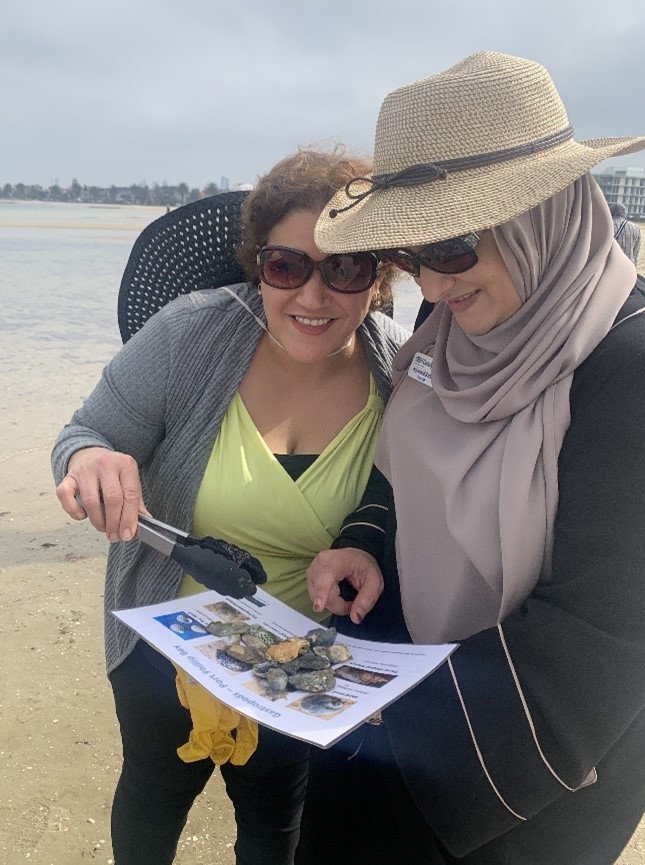
The aim of this project from Port Phillip EcoCentre is to build connections to Port Phillip Bay amongst Melbourne’s culturally and linguistically diverse (CALD) communities, improve understanding of the Bay’s values, and empower new volunteers to care for the Bay environment.
The project is addressing the gaps to volunteering through assisted and inclusive activities developed for CALD volunteers, together with adult migrant English program (AMEP) service providers and young leaders from within CALD communities.

Photo credit: Port Phillip EcoCentre
Over this two-year project, the EcoCentre is delivering a range of activities including:
- Bay-care volunteering excursions for AMEP students, incorporated into their English course curriculum, through trusted teachers and without out-of-pocket costs.
- Development of an EAL (English as an additional language) nature guide to address the often-technical language used in environmental resources, with hard copy resources for those with limited computer access and digital literacy.
- A Multicultural Bay Ambassadors program, training young professionals of CALD background in Bay-care community engagement and event delivery.
- Webinars focused on inclusion for bayside environmental groups, to address the unintended barriers to CALD participation presented by established volunteer groups around the Bay.
Empowering and inspiring people to care for the environment starts with developing links to place. This project is providing an opportunity to connect community with each other and with nature.

Photo credit: Port Phillip EcoCentre
Activity name: Establishing a baseline of Bay condition: pollutants and ecological indicators.
Activity reference number: 3.2.004.AA
Strategic lead: RMIT University
Port Phillip Bay is vulnerable to the pressures of anthropogenic activities, such as urbanisation and industrialisation, which discharge various pollutants impacting Bay health. Understanding these stressors, and how they influence ecological communities is critically important to ensuring long-term conservation of the Bay’s unique ecosystems.
In a collaboration between RMIT and Deakin University, this project will provide a baseline assessment of the pollutants and microbiome composition of sediment samples across the Bay.
The information collected will help determine the occurrence and distribution of pollutants, the biodiversity of sediments, and whether contaminated sediments are affecting key ecological processes in the Bay. It will guide actions to manage the impacts of anthropogenic activities on Bay health and contribute to the targets outlined in local and state government strategies.

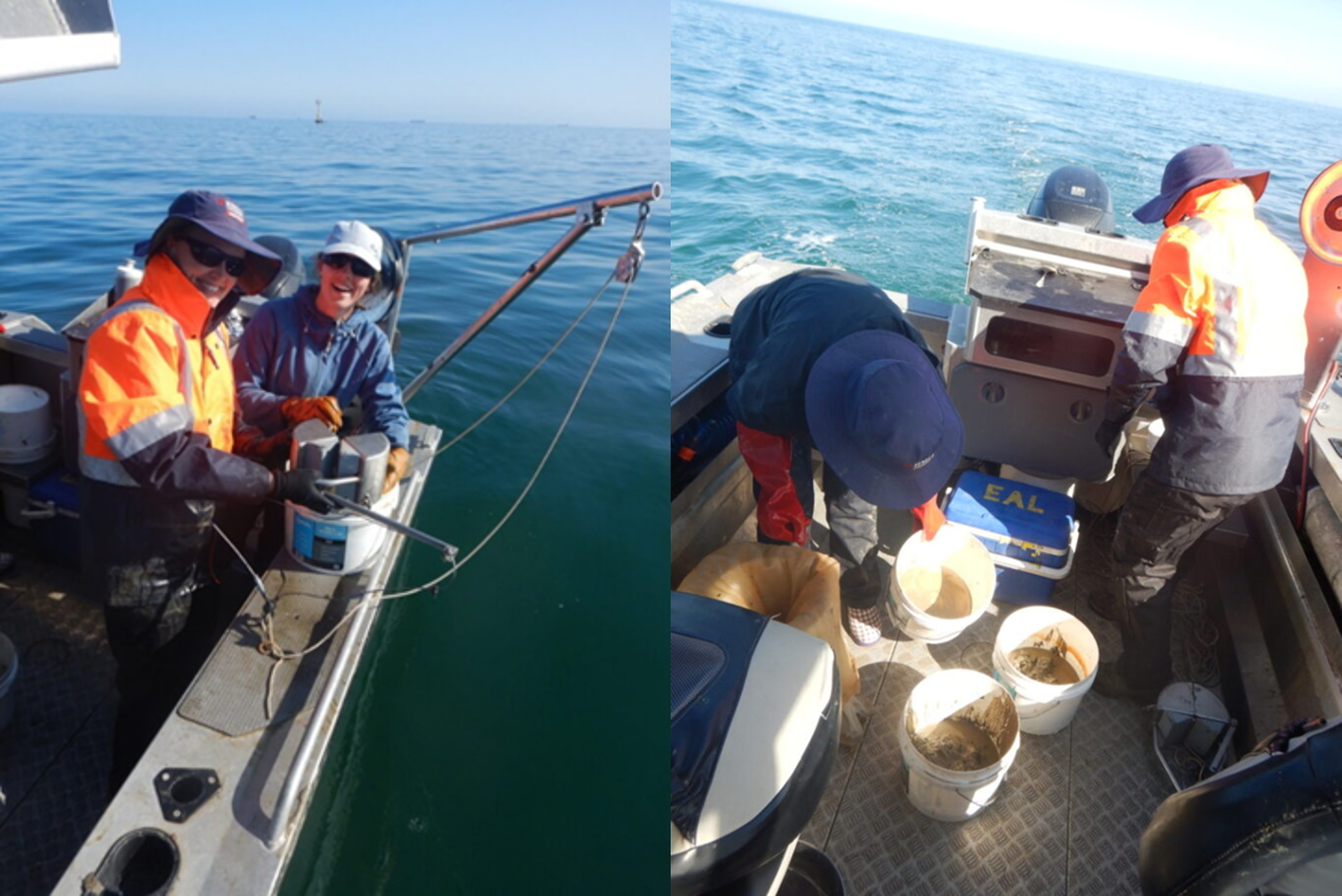
Photo credit: Sam Wines
Starting with sediment
Sediments are repositories for contaminants in marine ecosystems and can provide a fingerprint of emerging and historical contamination, including microplastics pollution. Sediments are also home to a diverse microbiome responsible for many ecological processes that maintain Bay health.
Sampling is being undertaken at 20 different sites across four regions within Port Phillip Bay. These regions are Hobsons Bay, Werribee, Geelong Arm and Mud Island.
All samples will undergo a chemical screen including metals, hydrocarbons, and pesticides as well as microplastics analysis. From the same locations, samples are being collected for microbiome analysis using eDNA metabarcoding to assess sediment biodiversity. Associations between microbiome communities and sediment contamination will be examined to identify if specific pollutants impact on ecosystem processes, and if any areas within the Bay are at greater risk from impacts.
On project completion, workshops will be held with relevant local and state government agencies, community groups and industry stakeholders to discuss project outcomes, raise awareness and identify actions to protect the Bay.

Photo credit: Sam Wines
Activity Name: Victorian Coastal Monitoring Program
Strategic lead: Department Energy, Environment and Climate Action
Activity reference numbers: 6.2.001.AD
Purpose
Originating in 2017, the Victorian Coastal Monitoring Program (VCMP) was established to better understand the drivers of coastal change along the shores of Victoria. As a partnership program between state government and universities, the VCMP aims to further our understanding of coastal change over time, assist with evidence-based decision making for present coastal management, and ensure coastal resilience into the future. The program incorporates surveys and monitoring, research projects, with citizen scientist and Traditional Owner integration involvement and support. The VCMP data is made available through the CoastKit and DataShare data portals. The large monitoring aspect of the VCMP is broken into three main components: a wave buoy network, static and livestreaming cameras, and aerial drone surveys.

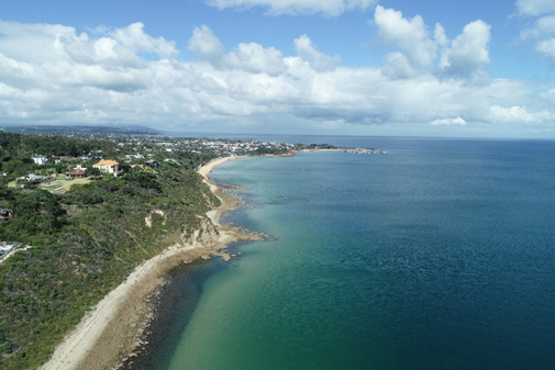
Photo credit: Caleb Dean
The drone surveys are conducted across more than 30 sites statewide, at an interval of 6-8 weeks between surveys at each site. More than 200 drone surveys are forecast for 2023-2024 with more than 1000 total surveys conducted since the program’s inception.
While the VCMP is a statewide project, approximately one third of the survey sites are within the Port Phillip Bay.
These sites are:
- Portsea
- Blairgowrie
- Rye
- Dromana
- Mount Martha
- Mornington
- Mount Eliza
- Patterson River
- Sandringham
- Altona
- Portarlington
- St Leonards
- Queenscliff
- Point Lonsdale

Photo credit: Rebecca Stuart
Drone survey methodology
This monitoring program is designed around the use of lightweight consumer drones which weigh under 2 kg. These units are light, easily flown, low cost, and can be safely flown commercially while abiding under legislation from the Civil Aviation Safety Authority. DEECA staff looks after the hardware, executes surveys independently, and conduct crowd control during flights.
The drones fly a preprogrammed mapping run to ensure consistency between surveys, capturing raw imagery, GPS location and associated metadata. The images are imported into the online Propeller Aero Portal where they are stitched into an orthomosaic model where the data can be cleaned and examined, and measurements and analysis can be made.
While the drones in use have high-accuracy RTK GPS units integrated into the airframe, the use of smart ground control targets (Propeller AeroPoints) allow for these flights to produce survey-grade data with centimetre horizontal and vertical accuracy. These innovative ground control points were created by an Australian company Propeller Aero who have partnered with the VCMP in this world-first program.
Page last updated: 22/10/25