The Environment Protection Authority Victoria (EPA) produces an annual Report Card (Water Quality Index), which gives a 12-month summary of the water quality for:
- Port Phillip Bay
- Western Port
- Gippsland Lakes and their catchments.
These bays and lakes are the largest coastal waterbodies in Victoria.
EPA and Melbourne Water monitor water quality in Port Phillip Bay and catchment regions while The Department of Energy, Environment and Climate Action (DEECA) also contributes monitoring efforts in Gippsland Lakes.
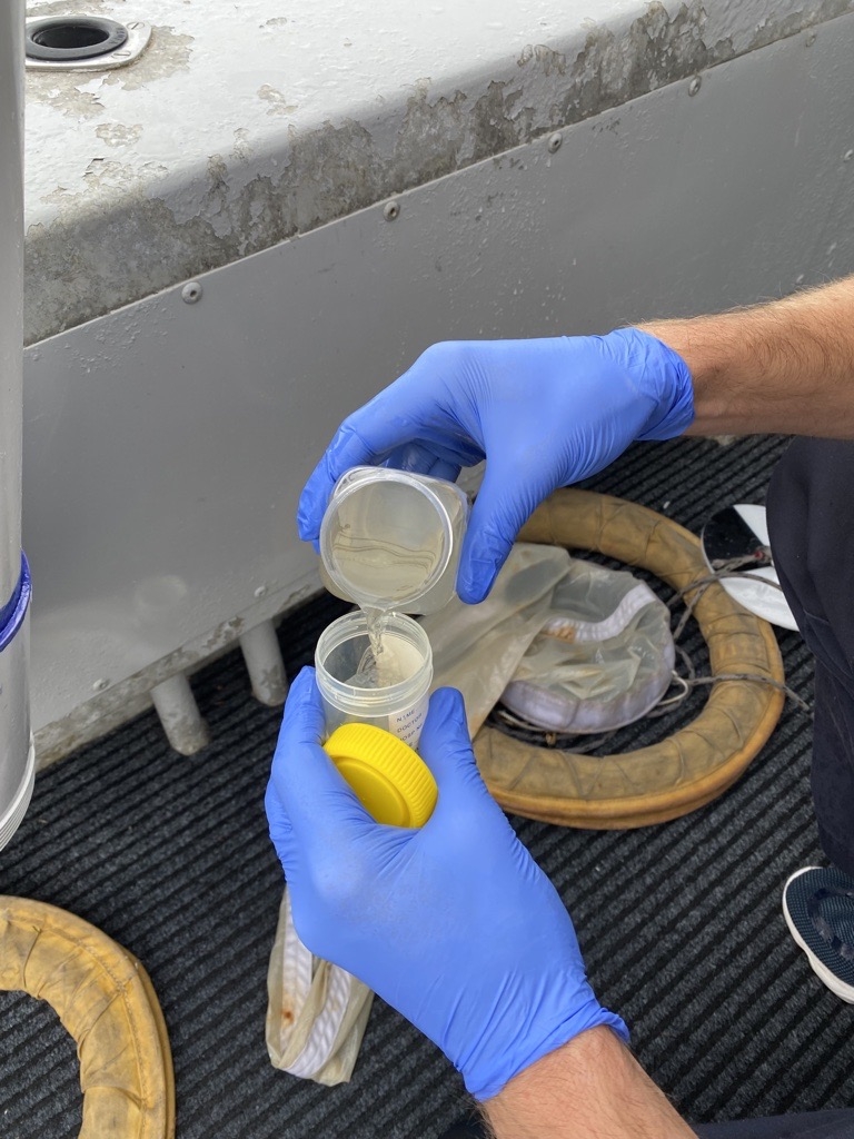
Photo Credit: Environment Protection Authority Victoria
Each year, EPA collect samples from the marine bays and lakes and Melbourne Water collect samples from waterways in greater Melbourne. The sampling data is then collated and used to calculate an annual rating based on key water quality indicators.
A rating of Very Good or Good indicates that water quality meets objectives in the Environment Reference Standard for Victoria. A rating of Poor or Very Poor indicates that the environmental condition of the waterway is under stress. Stressors such as excess nutrients (nitrogen and phosphorus), increased sediment and algal blooms are potential risks to the health of aquatic ecosystems.
The Water Quality Report Card provides an annual snapshot of long-term condition and shows a history for each region over the last 20 years. As water flows from upland forest, through agricultural land, and into urban environments, changes in land use such as urban growth, industrial activities, intensive agriculture and run-off from urban areas may impact water quality. Overall, water quality has stayed relatively steady, even though population pressures have increased over time.
Partner agency and data contributor:
Page last updated: 30/10/25