
Project context
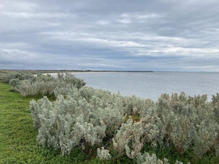
The Port Phillip Bay western shoreline is a unique part of the bay landscape with diverse marine and coastal values. These include Traditional Owner values and connection to country, internationally significant ecosystems such as Ramsar listed wetlands, parks and reserves, and a marine sanctuary.
The area is home to key facilities such as the Werribee agriculture precinct, Western Treatment Plant, oil refineries, Avalon Airport, and strategic national defence sites. It is also one of the fastest growing populations in Victoria.
Coastal hazards like erosion and flooding often impact the western shoreline. In the future, the region faces some of the highest risk for flooding of residential and industrial land across Victoria’s coast.
The Regional and Strategic Partnership (RASP)
The Port Phillip Bay Western Shoreline RASP has been established to respond to current and future coastal hazard impacts (including erosion, flooding and other hazards) across the region. The 10 RASP partners are:
- Bunurong Land Council Aboriginal Corporation
- Wadawurrung Traditional Owners Aboriginal Corporation
- City of Greater Geelong
- Hobsons Bay City Council
- Wyndham City Council
- Melbourne Water
- Parks Victoria
- Corangamite Catchment Management Authority
- Department of Transport and Planning
- Department of Energy, Environment and Climate Action.
Adapt West – Shaping our Shores is the project led by the RASP, that will deliver a Coastal Hazard Adaptation and Resilience Plan (CHARP) for the region.
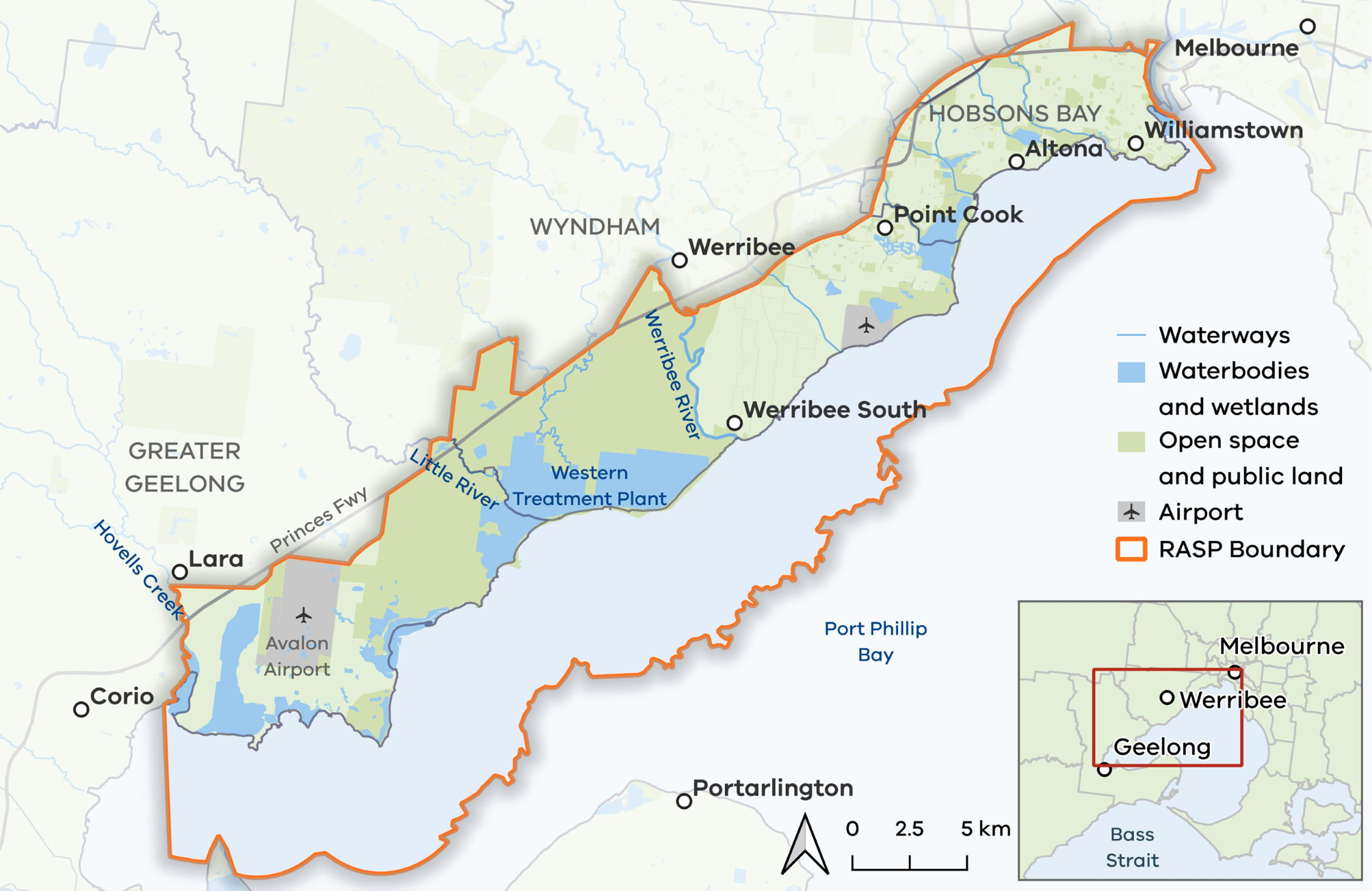
The project extent includes all marine and coastal areas that may be impacted by coastal hazards from now to 2100+, from Greenwich Reserve in Williamstown to Limeburners Bay/Hovells Creek Estuary north of Geelong.
Adapt West - Shaping our Shores project extent
The Coastal Hazard Adaptation and Resilience Plan (CHARP)
The Adapt West CHARP will ensure a shared understanding of the impacts of climate change on marine and coastal values, and provide long-term strategic guidance on management, decision making and investment.
The plan will be refined by 2026 and implemented by the RASP partners in following years.
The plan will identify shared priority actions, funding, roles and responsibilities, change management, triggers for review and a monitoring plan.
The CHARP development will:
- follow Victoria’s Resilient Coast framework and guidelines, Victoria’s Resilient Coast – Adapting for 2100+.
- use the recent data and information from the Port Phillip Bay Coastal Hazard Assessment (marineandcoasts.vic.gov.au).
Project stages
Stage 1: Scoping and preparation (2022–23)
Refinement of the RASP purpose and scope of the CHARP.
Stage 2: Values, vision and objectives (2024–25)
Technical, engagement and strategic studies with oversight from the RASP partners to progress the adaptation planning process.
Communication and engagement is a core part of the adaptation planning process. During 2024 and 2025, RASP partners and the broader community have explored topics to inform coastal hazard adaptation for the area, including:
- community values, usage and enjoyment of the western shoreline
- perceived threats to these values and uses
- what the community hopes to see in the future
- ideas, perspectives and preferences that may enable us to adapt and increase our resilience.
The outcomes of this stage are helping us better understand the region’s values. This includes:
- Community and social values assessment
- Ecological values assessment
- Traditional Owner Cultural Values Assessments on Bunurong Country and Wadawurrung Country (in progress)
- Stage 2 Summary Report (including strategic vision statement).
Stage 3: Coastal hazard exposure (2024–25)
An assessment of the coastal landscapes, processes and drivers of change across the Adapt West region. This stage draws on the Port Phillip Bay Coastal Hazard Assessment .
The outcomes of this stage provide us with coastal hazard information across a range of scenarios to inform risk assessment and adaptation planning. This includes:
- Stage 3 Summary report: Coastal hazard exposure
- Coastal hazard maps
Stage 4: Vulnerability and risk (2024–25)
This stage involves estimating the likely risk to social, community, environmental and cultural values in the project area, and the expected financial costs of those impacts. This work will enable the RASP partners plan and adapt for the future.
Stage 5: Adaptation actions and pathways (2026)
Consideration of various adaptation actions and pathways to protect the values identified in Stage 2 and respond to the risks highlighted in Stages 3 and 4.
Stages 6 & 7: Plan and implement, ongoing monitoring and review (2026)
Development of the Coastal Hazard Adaptation and Resilience Plan including consultation with rights holders, stakeholders and community.
Fact sheets and project updates
Fact Sheet 1 - Project overview
Engagement update 1 - values and experiences community engagement
Head to Engage Victoria to get involved: https://engage.vic.gov.au/adapt-west
Page last updated: 05/08/25