The Victorian Coastal Monitoring Program have developed a suite of Coastal Erosion Indicators (PDF, 18.3 MB), using drone and satellite data, to aid in coastal management, policy and planning.
The purpose of a Coastal Erosion Indicator is:
- To provide regular (e.g., annual) feedback equivalent to existing environmental indicators (e.g., water quality) that are commonly made available by DEECA (e.g., through the Port Phillip Bay Environmental Management Plan).
- To provide a single product output from the VCMP to summarise the current state of all regularly surveyed sites, with regard to coastal erosion.
- As a reference to coastal land and project managers.
- As a reference to coastal consultants and academics, e.g., to provide an overview of a site, prior to conducting a detailed coastal processes and/or hazard assessment.
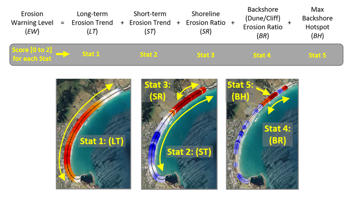
This report uses two erosion indicator tools: Erosion Warning Indicator (EWI) and Erosion Hotspot Detector (EHD).
The Coastal Erosion Indicators are now available on CoastKit. They can be found under the Victorian Coastal Monitoring Program section (see below).
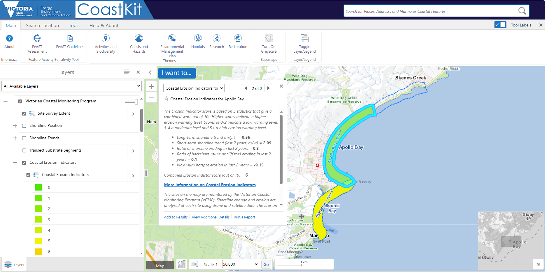
Note: Due to the quantity of information and graphics in the Coastal Erosion Indicator report (PDF, 18.3 MB), not all functionality of the report is displayed in CoastKit. As such, they should be simultaneously consulted.
Page last updated: 11/01/24