What is the Feature Atlas?
The Feature Atlas is a statewide mapping resource for Victoria's marine and coastal environment. It brings together environmental values, protected areas, infrastructure, human activities and management information into a single, standardised dataset that supports evidence based decision-making.
It provides a foundation for integrated marine and coastal planning, environmental assessment and decision support, enabling an ecosystem-based approach to managing Victoria's marine and coastal environment.
The 2020 Feature Atlas will be displayed on CoastKit and in FeAST report 's Proximity Analysis until work is finished to incorporate the 2026 update, expected late 2026.
The update to the 2026 Feature Atlas has seen these key changes:
- 150+ new and updated datasets
- Expanded coverage to included areas up to 5km inland from the coast
- Standardised polygon-based vector dataset
- Improved metadata, descriptions and provenance information
- New database structure and updated workflows
- Reorganised into 10 themes to 12 themes
Accessing the Feature Atlas
The Feature Atlas is currently available for download through Datashare and will be available on CoastKit in late 2026.
CoastKit is Victoria's marine and coastal mapping portal, allowing users to explore Feature Atlas layers alongside other marine and coastal datasets within a single mapping interface. These multiple datasets provide a shared evidence base for understanding the distribution and overlap of environmental values, human uses and infrastructure across Victoria's marine and coastal environment.

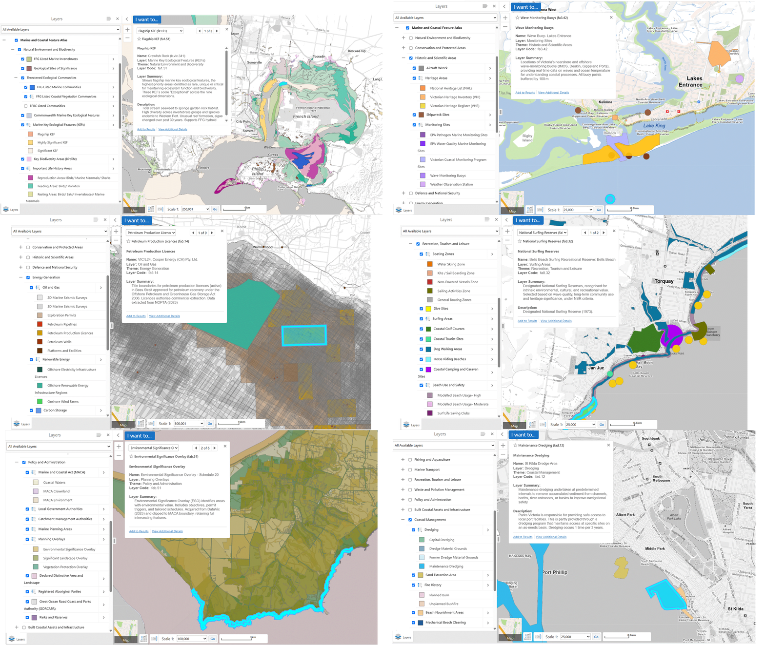
What's included in the Feature Atlas?
The Feature Atlas provides a statewide view of Victoria's marine and coastal environment, including areas covered by the Marine and Coastal Act 2018, extending up to 5 km inland from the coast. It brings together information from a wide range of publicly available government, research and industry data sources, comprising more than 95,000 mapped features, values and activities within a single, standardised dataset with enhanced metadata and descriptions.
A downloadable layer guide is available in addition to the FileGDB to help users explore and understand the datasets included in the Feature Atlas. The guide provides layer names, themes, reference numbers and summaries for all datasets within the Atlas.
Organised into 12 themes, the Feature Atlas helps users discover, identify and interpret marine and coastal features, values and activities. Explore the interactive Feature Atlas Widget below.
Decision-support applications
The Feature Atlas supports a range of marine and coastal planning, assessment and decision-support applications. The Feature Atlas is a core component of the Feature Activity Sensitivity Tool (FeAST), a decision-support tool that provides an automated, first-pass environmental risk assessment for proposed activities and developments within Victoria's marine and coastal environment. The Atlas underpins FeAST's Proximity Analysis, helping users identify marine and coastal features, values, activities and infrastructure located within or near a project area.
The Feature Atlas also provides a foundation for future Cumulative Impact Assessment (CIA) tools. By improving the spatial mapping of activities and associated pressures, the atlas enables a better understanding of the distribution, intensity and potential cumulative effects of human activities across Victoria's marine and coastal environment.
Download or contribute data
The Feature Atlas is available for download through Datashare and will continue to be updated as new information becomes available. If you identify an error, have updated information or would like to discuss contributing a dataset for inclusion in the Feature Atlas, please contact the CoastKit team at CoastKit@deeca.vic.gov.au.
Page last updated: 06/10/26